CAN Canberra, Australia - Earthquake Result Viewer
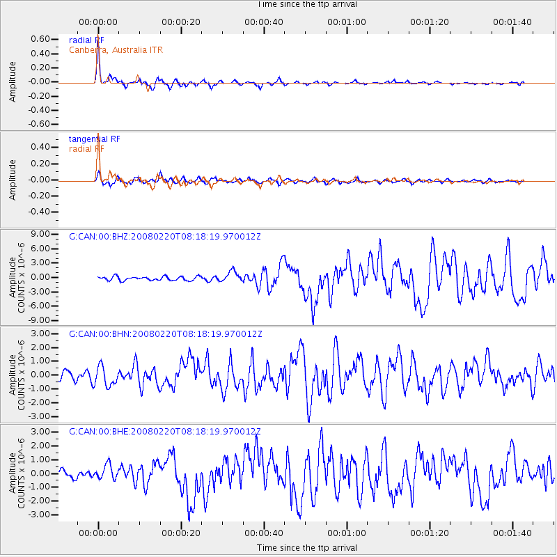
Earthquake location: Off W Coast Of Northern Sumatra
Earthquake latitude/longitude: 2.8/96.0
Earthquake time(UTC): 2008/02/20 (051) 08:08:30 GMT
Earthquake Depth: 26 km
Earthquake Magnitude: 6.5 MB, 7.5 MS, 7.4 MW, 7.4 MW
Earthquake Catalog/Contributor: WHDF/NEIC
Network: G GEOSCOPE
Station: CAN Canberra, Australia
Lat/Lon: 35.32 S/149.00 E
Elevation: 650 m
Distance: 62.4 deg
Az: 132.489 deg
Baz: 295.749 deg
Ray Param: 0.06022503
Estimated Moho Depth: 25.25 km
Estimated Crust Vp/Vs: 1.77
Assumed Crust Vp: 6.633 km/s
Estimated Crust Vs: 3.753 km/s
Estimated Crust Poisson's Ratio: 0.26
Radial Match: 93.69294 %
Radial Bump: 329
Transverse Match: 77.013084 %
Transverse Bump: 400
SOD ConfigId: 2564
Insert Time: 2010-02-26 21:37:02.046 +0000
GWidth: 2.5
Max Bumps: 400
Tol: 0.001

Signal To Noise

ChannelStoNSTALTA
G:CAN:00:BHN:20080220T08:18:19.970012Z2.49872167.0386125E-72.8168853E-7
G:CAN:00:BHE:20080220T08:18:19.970012Z1.58349875.3861527E-73.4014255E-7
G:CAN:00:BHZ:20080220T08:18:19.970012Z2.84359121.1346881E-63.990335E-7
Arrivals
Ps3.1 SECOND
PpPs10 SECOND
PsPs/PpSs13 SECOND