CAN Canberra, Australia - Earthquake Result Viewer
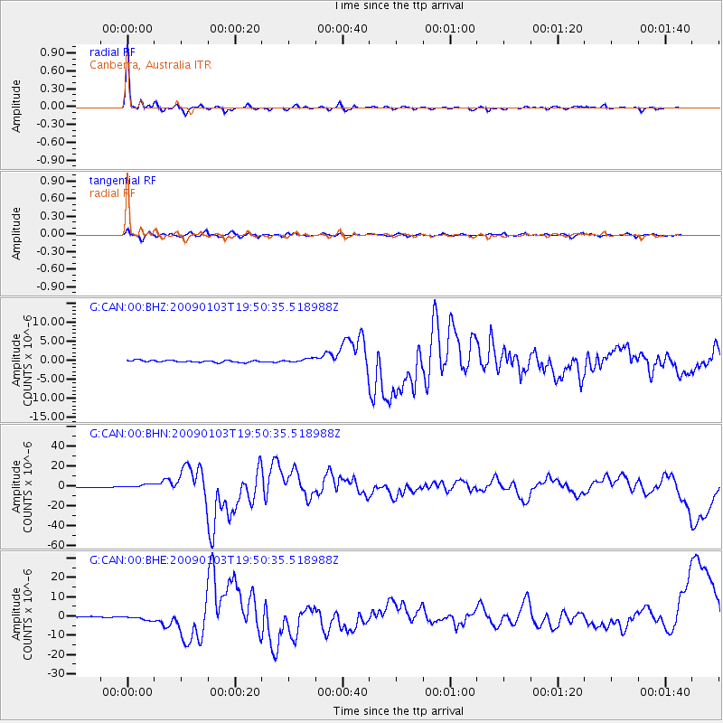
Earthquake location: Irian Jaya Region, Indonesia
Earthquake latitude/longitude: -0.4/132.9
Earthquake time(UTC): 2009/01/03 (003) 19:43:50 GMT
Earthquake Depth: 17 km
Earthquake Magnitude: 6.6 MB, 7.5 MS, 7.6 MW, 7.6 MW
Earthquake Catalog/Contributor: WHDF/NEIC
Network: G GEOSCOPE
Station: CAN Canberra, Australia
Lat/Lon: 35.32 S/149.00 E
Elevation: 650 m
Distance: 37.8 deg
Az: 158.285 deg
Baz: 333.1 deg
Ray Param: 0.07589042
Estimated Moho Depth: 23.75 km
Estimated Crust Vp/Vs: 1.63
Assumed Crust Vp: 6.633 km/s
Estimated Crust Vs: 4.057 km/s
Estimated Crust Poisson's Ratio: 0.20
Radial Match: 95.53111 %
Radial Bump: 250
Transverse Match: 82.18389 %
Transverse Bump: 400
SOD ConfigId: 2834
Insert Time: 2010-02-26 21:37:04.625 +0000
GWidth: 2.5
Max Bumps: 400
Tol: 0.001

Signal To Noise

ChannelStoNSTALTA
G:CAN:00:BHN:20090103T19:50:35.518988Z6.11964751.8750354E-63.0639598E-7
G:CAN:00:BHE:20090103T19:50:35.518988Z3.28965571.05038E-63.1929784E-7
G:CAN:00:BHZ:20090103T19:50:35.518988Z1.9725255.125371E-72.5983806E-7
Arrivals
Ps2.5 SECOND
PpPs8.7 SECOND
PsPs/PpSs11 SECOND