FUORN CH.FUORN - Earthquake Result Viewer
Earthquake location: Off East Coast Of Honshu, Japan
Earthquake latitude/longitude: 38.0/143.3
Earthquake time(UTC): 2011/07/10 (191) 00:57:10 GMT
Earthquake Depth: 23 km
Earthquake Magnitude: 6.6 MB, 7.0 MS, 7.0 MW, 7.0 MW
Earthquake Catalog/Contributor: WHDF/NEIC
Network: CH Switzerland Seismological Network
Station: FUORN CH.FUORN
Lat/Lon: 46.62 N/10.26 E
Elevation: 2333 m
Distance: 85.8 deg
Az: 329.639 deg
Baz: 35.385 deg
Ray Param: 0.04448551
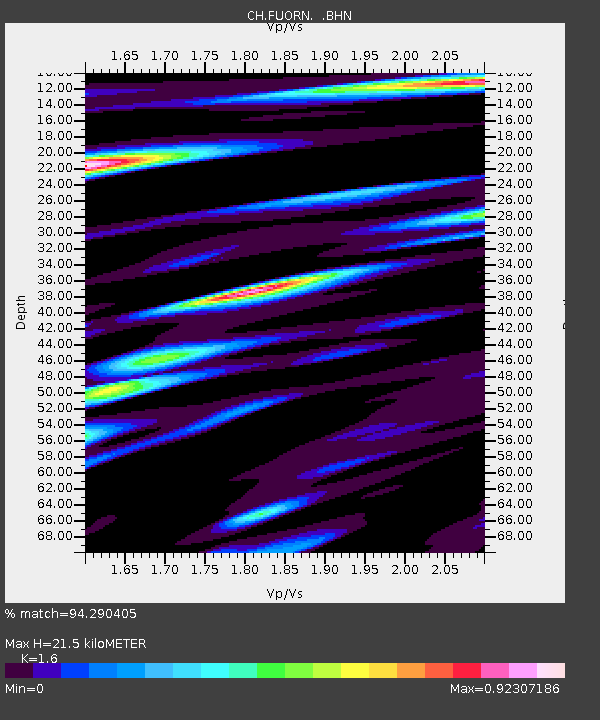
Estimated Moho Depth: 21.5 km
Estimated Crust Vp/Vs: 1.60
Assumed Crust Vp: 6.35 km/s
Estimated Crust Vs: 3.969 km/s
Estimated Crust Poisson's Ratio: 0.18
Radial Match: 94.290405 %
Radial Bump: 400
Transverse Match: 90.51942 %
Transverse Bump: 400
SOD ConfigId: 395004
Insert Time: 2011-12-16 05:48:22.485 +0000
GWidth: 2.5
Max Bumps: 400
Tol: 0.001

Signal To Noise

ChannelStoNSTALTA
CH:FUORN: :BHZ:20110710T01:09:16.792004Z25.4627361.1491225E-64.5129575E-8
CH:FUORN: :BHN:20110710T01:09:16.784009Z5.4629672.5844463E-74.7308475E-8
CH:FUORN: :BHE:20110710T01:09:16.800977Z4.9366111.9434721E-73.9368548E-8
Arrivals
Ps2.1 SECOND
PpPs8.6 SECOND
PsPs/PpSs11 SECOND