MUR Murrieta - Earthquake Result Viewer
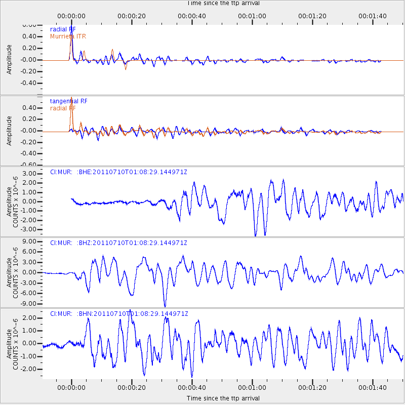
Earthquake location: Off East Coast Of Honshu, Japan
Earthquake latitude/longitude: 38.0/143.3
Earthquake time(UTC): 2011/07/10 (191) 00:57:10 GMT
Earthquake Depth: 23 km
Earthquake Magnitude: 6.6 MB, 7.0 MS, 7.0 MW, 7.0 MW
Earthquake Catalog/Contributor: WHDF/NEIC
Network: CI Caltech Regional Seismic Network
Station: MUR Murrieta
Lat/Lon: 33.60 N/117.20 W
Elevation: 562 m
Distance: 76.8 deg
Az: 57.725 deg
Baz: 306.877 deg
Ray Param: 0.050740615
Estimated Moho Depth: 68.25 km
Estimated Crust Vp/Vs: 2.04
Assumed Crust Vp: 6.264 km/s
Estimated Crust Vs: 3.078 km/s
Estimated Crust Poisson's Ratio: 0.34
Radial Match: 96.57702 %
Radial Bump: 376
Transverse Match: 79.470314 %
Transverse Bump: 400
SOD ConfigId: 395004
Insert Time: 2011-12-16 05:53:19.338 +0000
GWidth: 2.5
Max Bumps: 400
Tol: 0.001

Signal To Noise

ChannelStoNSTALTA
CI:MUR: :BHZ:20110710T01:08:29.144971Z6.62047779.52275E-71.4383781E-7
CI:MUR: :BHN:20110710T01:08:29.144971Z1.85642092.386869E-71.285737E-7
CI:MUR: :BHE:20110710T01:08:29.144971Z2.9284063.6136782E-71.2340085E-7
Arrivals
Ps12 SECOND
PpPs32 SECOND
PsPs/PpSs44 SECOND