
CLF Chambon la Foret observatory, France - Earthquake Result Viewer
| ||||||||||||||||||
| ||||||||||||||||||
| ||||||||||||||||||
|
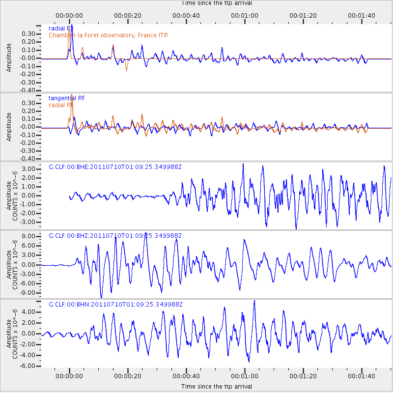
Signal To Noise
| Channel | StoN | STA | LTA |
| G:CLF:00:BHZ:20110710T01:09:25.349988Z | 11.726154 | 1.128323E-6 | 9.622276E-8 |
| G:CLF:00:BHN:20110710T01:09:25.349988Z | 1.5531619 | 3.4409913E-7 | 2.2154751E-7 |
| G:CLF:00:BHE:20110710T01:09:25.349988Z | 1.3659154 | 2.8320534E-7 | 2.073374E-7 |
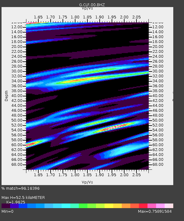
| Arrivals | |
| Ps | 8.4 SECOND |
| PpPs | 25 SECOND |
| PsPs/PpSs | 33 SECOND |

