ATD Arta Cave - Arta, Republic of Djibouti - Earthquake Result Viewer
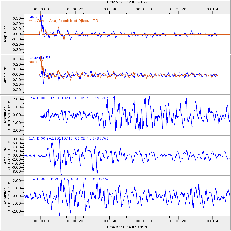
Earthquake location: Off East Coast Of Honshu, Japan
Earthquake latitude/longitude: 38.0/143.3
Earthquake time(UTC): 2011/07/10 (191) 00:57:10 GMT
Earthquake Depth: 23 km
Earthquake Magnitude: 6.6 MB, 7.0 MS, 7.0 MW, 7.0 MW
Earthquake Catalog/Contributor: WHDF/NEIC
Network: G GEOSCOPE
Station: ATD Arta Cave - Arta, Republic of Djibouti
Lat/Lon: 11.53 N/42.85 E
Elevation: 610 m
Distance: 91.0 deg
Az: 285.403 deg
Baz: 50.965 deg
Ray Param: 0.041628577
Estimated Moho Depth: 10.0 km
Estimated Crust Vp/Vs: 1.65
Assumed Crust Vp: 6.375 km/s
Estimated Crust Vs: 3.869 km/s
Estimated Crust Poisson's Ratio: 0.21
Radial Match: 92.92306 %
Radial Bump: 400
Transverse Match: 83.945 %
Transverse Bump: 400
SOD ConfigId: 395004
Insert Time: 2011-12-16 06:13:02.570 +0000
GWidth: 2.5
Max Bumps: 400
Tol: 0.001

Signal To Noise

ChannelStoNSTALTA
G:ATD:00:BHZ:20110710T01:09:41.649976Z5.1515981.602155E-63.1100157E-7
G:ATD:00:BHN:20110710T01:09:41.649976Z2.00273354.362371E-72.1782083E-7
G:ATD:00:BHE:20110710T01:09:41.649976Z1.51929535.3012064E-73.4892534E-7
Arrivals
Ps1.0 SECOND
PpPs4.1 SECOND
PsPs/PpSs5.1 SECOND