GRFO Grafenberg, Germany - Earthquake Result Viewer
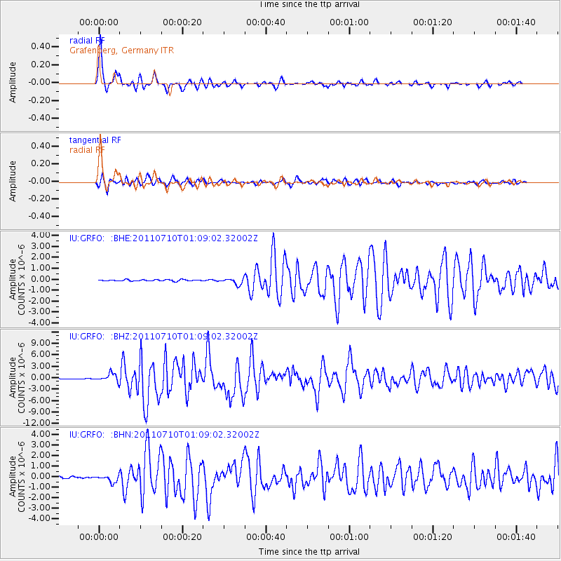
Earthquake location: Off East Coast Of Honshu, Japan
Earthquake latitude/longitude: 38.0/143.3
Earthquake time(UTC): 2011/07/10 (191) 00:57:10 GMT
Earthquake Depth: 23 km
Earthquake Magnitude: 6.6 MB, 7.0 MS, 7.0 MW, 7.0 MW
Earthquake Catalog/Contributor: WHDF/NEIC
Network: IU Global Seismograph Network (GSN - IRIS/USGS)
Station: GRFO Grafenberg, Germany
Lat/Lon: 49.69 N/11.22 E
Elevation: 384 m
Distance: 82.9 deg
Az: 330.923 deg
Baz: 36.222 deg
Ray Param: 0.04652352
Estimated Moho Depth: 32.25 km
Estimated Crust Vp/Vs: 1.60
Assumed Crust Vp: 6.182 km/s
Estimated Crust Vs: 3.864 km/s
Estimated Crust Poisson's Ratio: 0.18
Radial Match: 97.01282 %
Radial Bump: 300
Transverse Match: 93.68463 %
Transverse Bump: 400
SOD ConfigId: 395004
Insert Time: 2011-12-16 06:16:04.163 +0000
GWidth: 2.5
Max Bumps: 400
Tol: 0.001

Signal To Noise

ChannelStoNSTALTA
IU:GRFO: :BHZ:20110710T01:09:02.32002Z19.238531.0877103E-65.653812E-8
IU:GRFO: :BHN:20110710T01:09:02.32002Z4.61315253.46188E-77.504369E-8
IU:GRFO: :BHE:20110710T01:09:02.32002Z4.76161772.917809E-76.127769E-8
Arrivals
Ps3.2 SECOND
PpPs13 SECOND
PsPs/PpSs16 SECOND