M04C Macdoel, CA, USA - Earthquake Result Viewer
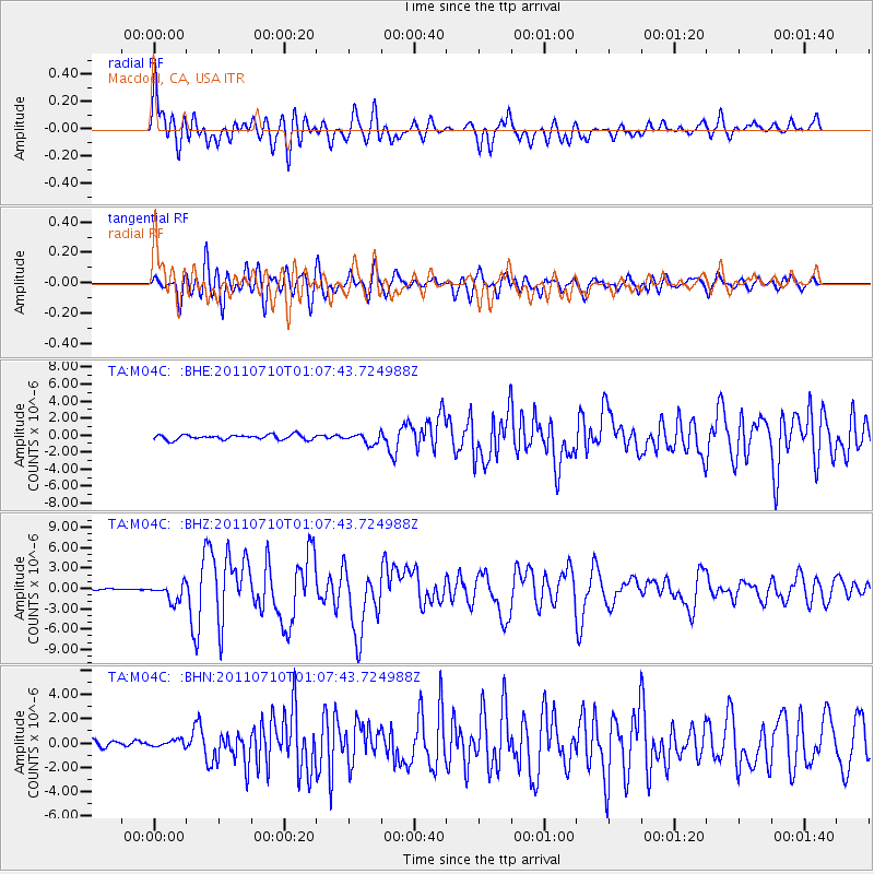
Earthquake location: Off East Coast Of Honshu, Japan
Earthquake latitude/longitude: 38.0/143.3
Earthquake time(UTC): 2011/07/10 (191) 00:57:10 GMT
Earthquake Depth: 23 km
Earthquake Magnitude: 6.6 MB, 7.0 MS, 7.0 MW, 7.0 MW
Earthquake Catalog/Contributor: WHDF/NEIC
Network: TA USArray Transportable Network (new EarthScope stations)
Station: M04C Macdoel, CA, USA
Lat/Lon: 41.78 N/121.84 W
Elevation: 1391 m
Distance: 69.1 deg
Az: 52.911 deg
Baz: 302.624 deg
Ray Param: 0.05584922
Estimated Moho Depth: 60.75 km
Estimated Crust Vp/Vs: 1.64
Assumed Crust Vp: 6.566 km/s
Estimated Crust Vs: 4.004 km/s
Estimated Crust Poisson's Ratio: 0.20
Radial Match: 89.88619 %
Radial Bump: 400
Transverse Match: 87.79821 %
Transverse Bump: 400
SOD ConfigId: 395004
Insert Time: 2011-12-16 06:25:23.236 +0000
GWidth: 2.5
Max Bumps: 400
Tol: 0.001

Signal To Noise

ChannelStoNSTALTA
TA:M04C: :BHZ:20110710T01:07:43.724988Z10.0282821.2951851E-61.2915325E-7
TA:M04C: :BHN:20110710T01:07:43.724988Z1.41439142.9387942E-72.0777802E-7
TA:M04C: :BHE:20110710T01:07:43.724988Z2.15948376.049143E-72.8011988E-7
Arrivals
Ps6.2 SECOND
PpPs23 SECOND
PsPs/PpSs30 SECOND