F30A Leola, SD, USA - Earthquake Result Viewer
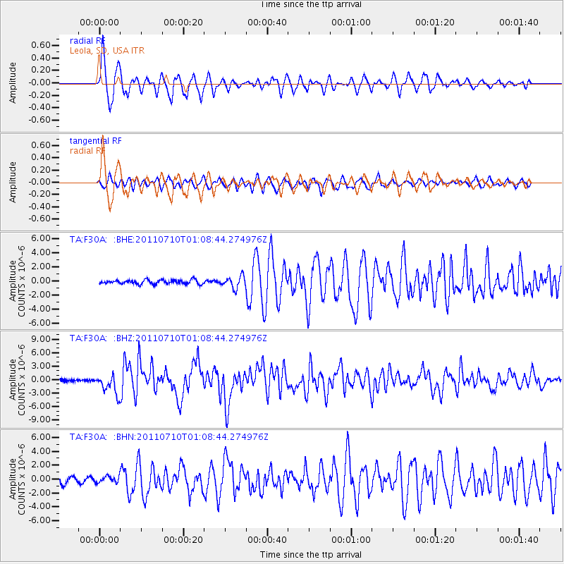
Earthquake location: Off East Coast Of Honshu, Japan
Earthquake latitude/longitude: 38.0/143.3
Earthquake time(UTC): 2011/07/10 (191) 00:57:10 GMT
Earthquake Depth: 23 km
Earthquake Magnitude: 6.6 MB, 7.0 MS, 7.0 MW, 7.0 MW
Earthquake Catalog/Contributor: WHDF/NEIC
Network: TA USArray Transportable Network (new EarthScope stations)
Station: F30A Leola, SD, USA
Lat/Lon: 45.84 N/99.03 W
Elevation: 601 m
Distance: 79.5 deg
Az: 39.009 deg
Baz: 314.688 deg
Ray Param: 0.048883587
Estimated Moho Depth: 12.5 km
Estimated Crust Vp/Vs: 1.60
Assumed Crust Vp: 6.53 km/s
Estimated Crust Vs: 4.082 km/s
Estimated Crust Poisson's Ratio: 0.18
Radial Match: 94.67581 %
Radial Bump: 389
Transverse Match: 86.52559 %
Transverse Bump: 400
SOD ConfigId: 395004
Insert Time: 2011-12-16 06:29:11.693 +0000
GWidth: 2.5
Max Bumps: 400
Tol: 0.001

Signal To Noise

ChannelStoNSTALTA
TA:F30A: :BHZ:20110710T01:08:44.274976Z12.073542.2380384E-61.8536723E-7
TA:F30A: :BHN:20110710T01:08:44.274976Z1.03523254.726967E-74.5660923E-7
TA:F30A: :BHE:20110710T01:08:44.274976Z3.03731328.6156234E-72.8365938E-7
Arrivals
Ps1.2 SECOND
PpPs4.8 SECOND
PsPs/PpSs6.0 SECOND