I30A Oacoma, SD, USA - Earthquake Result Viewer
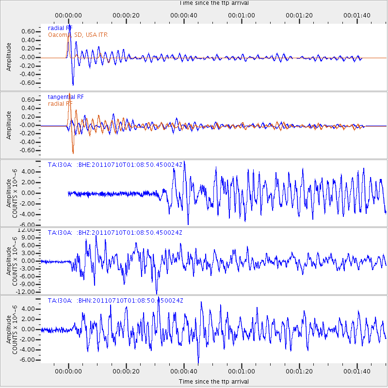
Earthquake location: Off East Coast Of Honshu, Japan
Earthquake latitude/longitude: 38.0/143.3
Earthquake time(UTC): 2011/07/10 (191) 00:57:10 GMT
Earthquake Depth: 23 km
Earthquake Magnitude: 6.6 MB, 7.0 MS, 7.0 MW, 7.0 MW
Earthquake Catalog/Contributor: WHDF/NEIC
Network: TA USArray Transportable Network (new EarthScope stations)
Station: I30A Oacoma, SD, USA
Lat/Lon: 43.91 N/99.43 W
Elevation: 549 m
Distance: 80.7 deg
Az: 40.6 deg
Baz: 314.679 deg
Ray Param: 0.048099782
Estimated Moho Depth: 28.0 km
Estimated Crust Vp/Vs: 1.66
Assumed Crust Vp: 6.53 km/s
Estimated Crust Vs: 3.934 km/s
Estimated Crust Poisson's Ratio: 0.22
Radial Match: 96.9151 %
Radial Bump: 367
Transverse Match: 91.81445 %
Transverse Bump: 400
SOD ConfigId: 395004
Insert Time: 2011-12-16 06:29:56.949 +0000
GWidth: 2.5
Max Bumps: 400
Tol: 0.001

Signal To Noise

ChannelStoNSTALTA
TA:I30A: :BHZ:20110710T01:08:50.450024Z12.4544412.3768E-61.9083956E-7
TA:I30A: :BHN:20110710T01:08:50.450024Z3.39831648.262907E-72.431471E-7
TA:I30A: :BHE:20110710T01:08:50.450024Z4.01697838.1977157E-72.0407666E-7
Arrivals
Ps2.9 SECOND
PpPs11 SECOND
PsPs/PpSs14 SECOND