K30A Basset, NE, USA - Earthquake Result Viewer
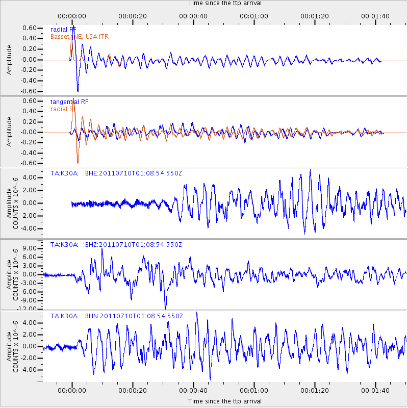
Earthquake location: Off East Coast Of Honshu, Japan
Earthquake latitude/longitude: 38.0/143.3
Earthquake time(UTC): 2011/07/10 (191) 00:57:10 GMT
Earthquake Depth: 23 km
Earthquake Magnitude: 6.6 MB, 7.0 MS, 7.0 MW, 7.0 MW
Earthquake Catalog/Contributor: WHDF/NEIC
Network: TA USArray Transportable Network (new EarthScope stations)
Station: K30A Basset, NE, USA
Lat/Lon: 42.67 N/99.61 W
Elevation: 712 m
Distance: 81.4 deg
Az: 41.589 deg
Baz: 314.706 deg
Ray Param: 0.04756229
Estimated Moho Depth: 10.0 km
Estimated Crust Vp/Vs: 1.63
Assumed Crust Vp: 6.53 km/s
Estimated Crust Vs: 4.006 km/s
Estimated Crust Poisson's Ratio: 0.20
Radial Match: 96.543686 %
Radial Bump: 400
Transverse Match: 85.378494 %
Transverse Bump: 400
SOD ConfigId: 395004
Insert Time: 2011-12-16 06:30:11.967 +0000
GWidth: 2.5
Max Bumps: 400
Tol: 0.001

Signal To Noise

ChannelStoNSTALTA
TA:K30A: :BHZ:20110710T01:08:54.550Z8.4196461.6880263E-62.0048658E-7
TA:K30A: :BHN:20110710T01:08:54.550Z2.87570986.2723063E-72.1811333E-7
TA:K30A: :BHE:20110710T01:08:54.550Z2.25372226.020456E-72.6713388E-7
Arrivals
Ps1.0 SECOND
PpPs3.9 SECOND
PsPs/PpSs4.9 SECOND