K04D Chiloquin, OR, USA - Earthquake Result Viewer
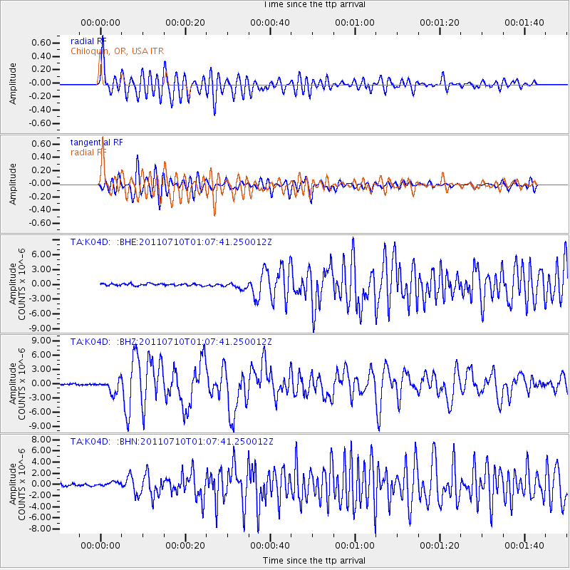
Earthquake location: Off East Coast Of Honshu, Japan
Earthquake latitude/longitude: 38.0/143.3
Earthquake time(UTC): 2011/07/10 (191) 00:57:10 GMT
Earthquake Depth: 23 km
Earthquake Magnitude: 6.6 MB, 7.0 MS, 7.0 MW, 7.0 MW
Earthquake Catalog/Contributor: WHDF/NEIC
Network: TA USArray Transportable Network (new EarthScope stations)
Station: K04D Chiloquin, OR, USA
Lat/Lon: 42.62 N/121.75 W
Elevation: 1315 m
Distance: 68.7 deg
Az: 52.113 deg
Baz: 302.394 deg
Ray Param: 0.056109767
Estimated Moho Depth: 45.0 km
Estimated Crust Vp/Vs: 2.02
Assumed Crust Vp: 6.597 km/s
Estimated Crust Vs: 3.274 km/s
Estimated Crust Poisson's Ratio: 0.34
Radial Match: 88.32625 %
Radial Bump: 400
Transverse Match: 85.540504 %
Transverse Bump: 400
SOD ConfigId: 395004
Insert Time: 2011-12-16 06:30:44.807 +0000
GWidth: 2.5
Max Bumps: 400
Tol: 0.001

Signal To Noise

ChannelStoNSTALTA
TA:K04D: :BHZ:20110710T01:07:41.250012Z10.8746911.382231E-61.2710531E-7
TA:K04D: :BHN:20110710T01:07:41.250012Z2.5348944.7601327E-71.8778428E-7
TA:K04D: :BHE:20110710T01:07:41.250012Z3.3811086.4337274E-71.9028458E-7
Arrivals
Ps7.2 SECOND
PpPs20 SECOND
PsPs/PpSs27 SECOND