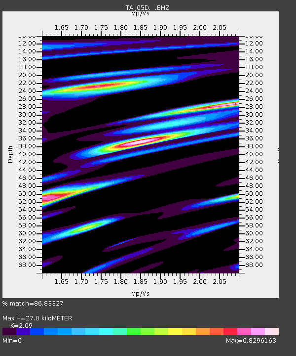
J05D Fort Rock, OR, USA - Earthquake Result Viewer
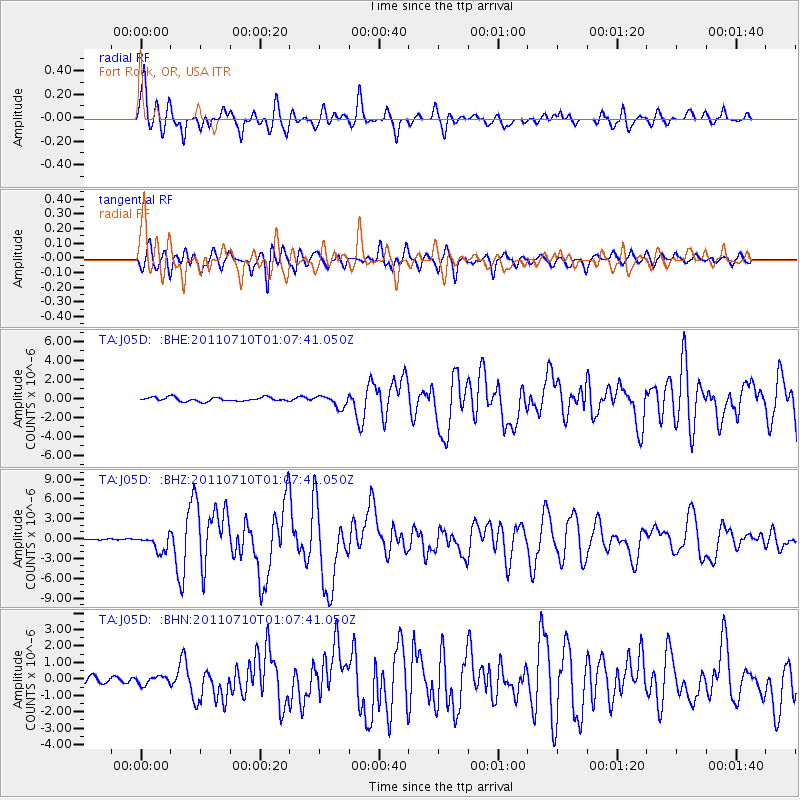
Earthquake location: Off East Coast Of Honshu, Japan
Earthquake latitude/longitude: 38.0/143.3
Earthquake time(UTC): 2011/07/10 (191) 00:57:10 GMT
Earthquake Depth: 23 km
Earthquake Magnitude: 6.6 MB, 7.0 MS, 7.0 MW, 7.0 MW
Earthquake Catalog/Contributor: WHDF/NEIC
Network: TA USArray Transportable Network (new EarthScope stations)
Station: J05D Fort Rock, OR, USA
Lat/Lon: 43.28 N/121.23 W
Elevation: 1541 m
Distance: 68.7 deg
Az: 51.296 deg
Baz: 302.449 deg
Ray Param: 0.056130867
Estimated Moho Depth: 27.0 km
Estimated Crust Vp/Vs: 2.09
Assumed Crust Vp: 6.597 km/s
Estimated Crust Vs: 3.157 km/s
Estimated Crust Poisson's Ratio: 0.35
Radial Match: 86.83327 %
Radial Bump: 400
Transverse Match: 88.59055 %
Transverse Bump: 400
SOD ConfigId: 395004
Insert Time: 2011-12-16 06:31:00.002 +0000
GWidth: 2.5
Max Bumps: 400
Tol: 0.001

Signal To Noise

ChannelStoNSTALTA
TA:J05D: :BHZ:20110710T01:07:41.050Z9.6526621.2434634E-61.2882077E-7
TA:J05D: :BHN:20110710T01:07:41.050Z1.06291822.4727308E-72.3263605E-7
TA:J05D: :BHE:20110710T01:07:41.050Z2.948836.168954E-72.0920007E-7
Arrivals
Ps4.6 SECOND
PpPs12 SECOND
PsPs/PpSs17 SECOND