V32A Arapaho, OK, USA - Earthquake Result Viewer
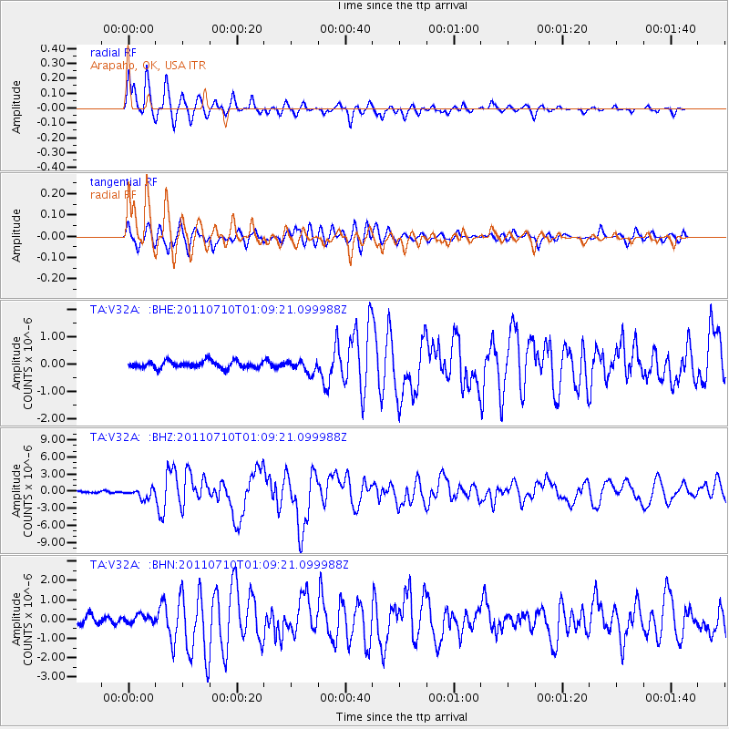
Earthquake location: Off East Coast Of Honshu, Japan
Earthquake latitude/longitude: 38.0/143.3
Earthquake time(UTC): 2011/07/10 (191) 00:57:10 GMT
Earthquake Depth: 23 km
Earthquake Magnitude: 6.6 MB, 7.0 MS, 7.0 MW, 7.0 MW
Earthquake Catalog/Contributor: WHDF/NEIC
Network: TA USArray Transportable Network (new EarthScope stations)
Station: V32A Arapaho, OK, USA
Lat/Lon: 35.72 N/99.04 W
Elevation: 533 m
Distance: 86.7 deg
Az: 46.198 deg
Baz: 315.543 deg
Ray Param: 0.043856785
Estimated Moho Depth: 40.25 km
Estimated Crust Vp/Vs: 2.06
Assumed Crust Vp: 6.315 km/s
Estimated Crust Vs: 3.062 km/s
Estimated Crust Poisson's Ratio: 0.35
Radial Match: 95.14834 %
Radial Bump: 383
Transverse Match: 87.72146 %
Transverse Bump: 400
SOD ConfigId: 395004
Insert Time: 2011-12-16 06:33:06.149 +0000
GWidth: 2.5
Max Bumps: 400
Tol: 0.001

Signal To Noise

ChannelStoNSTALTA
TA:V32A: :BHZ:20110710T01:09:21.099988Z6.2845228.562109E-71.3624121E-7
TA:V32A: :BHN:20110710T01:09:21.099988Z1.0010652.0198462E-72.0176974E-7
TA:V32A: :BHE:20110710T01:09:21.099988Z1.71684252.2061849E-71.2850246E-7
Arrivals
Ps6.9 SECOND
PpPs19 SECOND
PsPs/PpSs26 SECOND