N02D Trinity Center, CA, USA - Earthquake Result Viewer
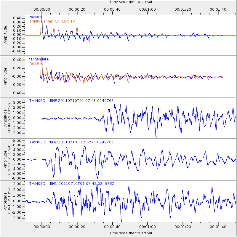
Earthquake location: Off East Coast Of Honshu, Japan
Earthquake latitude/longitude: 38.0/143.3
Earthquake time(UTC): 2011/07/10 (191) 00:57:10 GMT
Earthquake Depth: 23 km
Earthquake Magnitude: 6.6 MB, 7.0 MS, 7.0 MW, 7.0 MW
Earthquake Catalog/Contributor: WHDF/NEIC
Network: TA USArray Transportable Network (new EarthScope stations)
Station: N02D Trinity Center, CA, USA
Lat/Lon: 40.97 N/122.71 W
Elevation: 937 m
Distance: 69.0 deg
Az: 54.015 deg
Baz: 302.449 deg
Ray Param: 0.055924244
Estimated Moho Depth: 23.75 km
Estimated Crust Vp/Vs: 1.81
Assumed Crust Vp: 6.566 km/s
Estimated Crust Vs: 3.628 km/s
Estimated Crust Poisson's Ratio: 0.28
Radial Match: 90.94908 %
Radial Bump: 400
Transverse Match: 89.673065 %
Transverse Bump: 400
SOD ConfigId: 395004
Insert Time: 2011-12-16 06:33:37.910 +0000
GWidth: 2.5
Max Bumps: 400
Tol: 0.001

Signal To Noise

ChannelStoNSTALTA
TA:N02D: :BHZ:20110710T01:07:43.024976Z13.5246561.1407158E-68.434341E-8
TA:N02D: :BHN:20110710T01:07:43.024976Z1.64043522.6447256E-71.6122097E-7
TA:N02D: :BHE:20110710T01:07:43.024976Z3.42694933.2588278E-79.509414E-8
Arrivals
Ps3.0 SECOND
PpPs9.8 SECOND
PsPs/PpSs13 SECOND