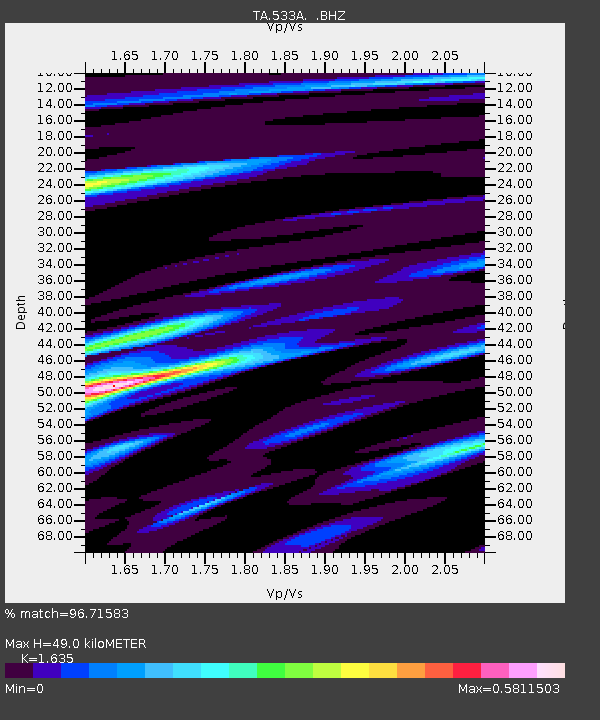
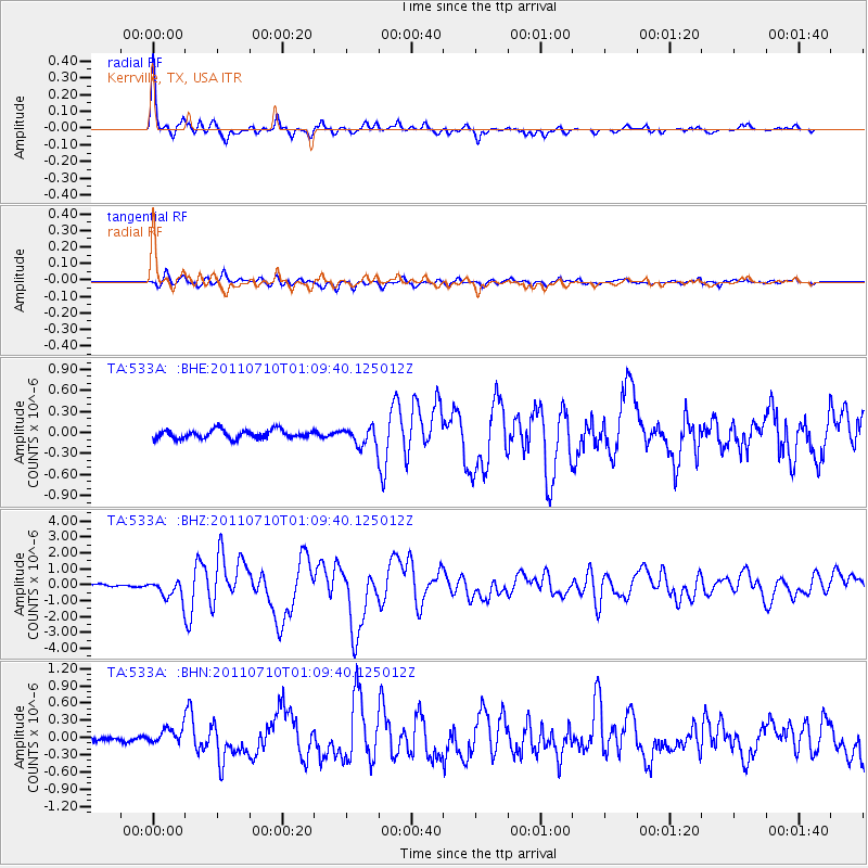
533A Kerrville, TX, USA - Earthquake Result Viewer

Earthquake location: Off East Coast Of Honshu, Japan
Earthquake latitude/longitude: 38.0/143.3
Earthquake time(UTC): 2011/07/10 (191) 00:57:10 GMT
Earthquake Depth: 23 km
Earthquake Magnitude: 6.6 MB, 7.0 MS, 7.0 MW, 7.0 MW
Earthquake Catalog/Contributor: WHDF/NEIC
Network: TA USArray Transportable Network (new EarthScope stations)
Station: 533A Kerrville, TX, USA
Lat/Lon: 30.07 N/99.04 W
Elevation: 556 m
Distance: 90.7 deg
Az: 50.135 deg
Baz: 315.637 deg
Ray Param: 0.04165221
Estimated Moho Depth: 49.0 km
Estimated Crust Vp/Vs: 1.63
Assumed Crust Vp: 6.498 km/s
Estimated Crust Vs: 3.974 km/s
Estimated Crust Poisson's Ratio: 0.20
Radial Match: 96.71583 %
Radial Bump: 358
Transverse Match: 85.38828 %
Transverse Bump: 400
SOD ConfigId: 395004
Insert Time: 2011-12-16 06:33:57.097 +0000
GWidth: 2.5
Max Bumps: 400
Tol: 0.001

Signal To Noise

ChannelStoNSTALTA
TA:533A: :BHZ:20110710T01:09:40.125012Z6.7299835.919442E-78.795627E-8
TA:533A: :BHN:20110710T01:09:40.125012Z3.49493171.3521648E-73.8689304E-8
TA:533A: :BHE:20110710T01:09:40.125012Z2.158261.3088099E-76.0641895E-8
Arrivals
Ps4.9 SECOND
PpPs19 SECOND
PsPs/PpSs24 SECOND