L02D Cave Junction, OR, USA - Earthquake Result Viewer
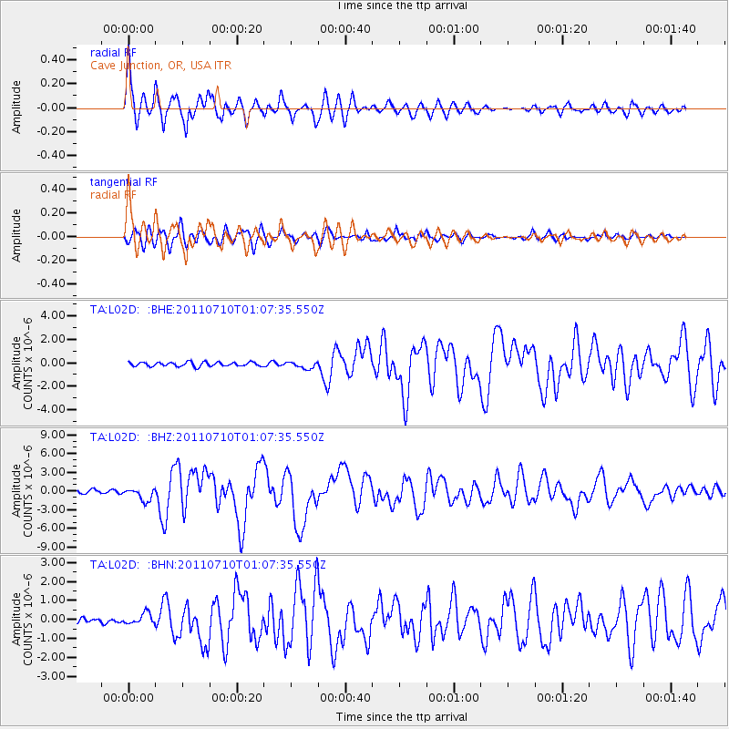
Earthquake location: Off East Coast Of Honshu, Japan
Earthquake latitude/longitude: 38.0/143.3
Earthquake time(UTC): 2011/07/10 (191) 00:57:10 GMT
Earthquake Depth: 23 km
Earthquake Magnitude: 6.6 MB, 7.0 MS, 7.0 MW, 7.0 MW
Earthquake Catalog/Contributor: WHDF/NEIC
Network: TA USArray Transportable Network (new EarthScope stations)
Station: L02D Cave Junction, OR, USA
Lat/Lon: 42.16 N/123.60 W
Elevation: 458 m
Distance: 67.8 deg
Az: 53.321 deg
Baz: 301.6 deg
Ray Param: 0.056707274
Estimated Moho Depth: 18.5 km
Estimated Crust Vp/Vs: 1.92
Assumed Crust Vp: 6.522 km/s
Estimated Crust Vs: 3.392 km/s
Estimated Crust Poisson's Ratio: 0.31
Radial Match: 92.63037 %
Radial Bump: 400
Transverse Match: 83.51229 %
Transverse Bump: 400
SOD ConfigId: 395004
Insert Time: 2011-12-16 06:34:26.392 +0000
GWidth: 2.5
Max Bumps: 400
Tol: 0.001

Signal To Noise

ChannelStoNSTALTA
TA:L02D: :BHZ:20110710T01:07:35.550Z4.292251.029558E-62.398644E-7
TA:L02D: :BHN:20110710T01:07:35.550Z1.41028612.855651E-72.0248737E-7
TA:L02D: :BHE:20110710T01:07:35.550Z1.68019022.9216332E-71.7388706E-7
Arrivals
Ps2.7 SECOND
PpPs8.0 SECOND
PsPs/PpSs11 SECOND