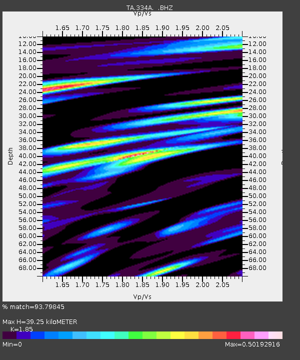
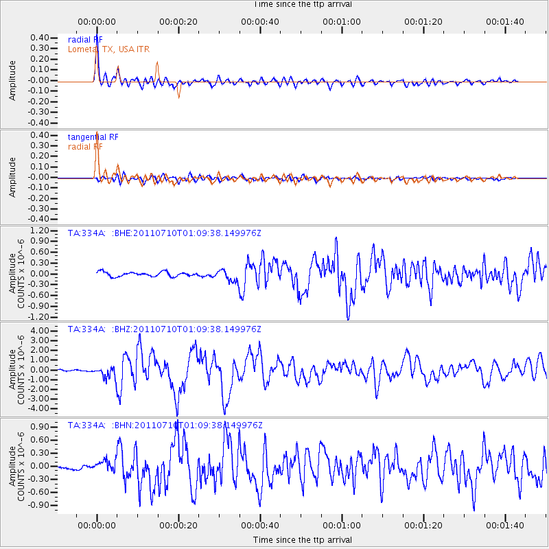
334A Lometa, TX, USA - Earthquake Result Viewer

Earthquake location: Off East Coast Of Honshu, Japan
Earthquake latitude/longitude: 38.0/143.3
Earthquake time(UTC): 2011/07/10 (191) 00:57:10 GMT
Earthquake Depth: 23 km
Earthquake Magnitude: 6.6 MB, 7.0 MS, 7.0 MW, 7.0 MW
Earthquake Catalog/Contributor: WHDF/NEIC
Network: TA USArray Transportable Network (new EarthScope stations)
Station: 334A Lometa, TX, USA
Lat/Lon: 31.33 N/98.24 W
Elevation: 389 m
Distance: 90.3 deg
Az: 48.767 deg
Baz: 316.054 deg
Ray Param: 0.0416824
Estimated Moho Depth: 39.25 km
Estimated Crust Vp/Vs: 1.85
Assumed Crust Vp: 6.498 km/s
Estimated Crust Vs: 3.512 km/s
Estimated Crust Poisson's Ratio: 0.29
Radial Match: 93.79845 %
Radial Bump: 400
Transverse Match: 68.26429 %
Transverse Bump: 400
SOD ConfigId: 395004
Insert Time: 2011-12-16 06:34:58.289 +0000
GWidth: 2.5
Max Bumps: 400
Tol: 0.001

Signal To Noise

ChannelStoNSTALTA
TA:334A: :BHZ:20110710T01:09:38.149976Z7.863326.156647E-77.829577E-8
TA:334A: :BHN:20110710T01:09:38.149976Z2.16867141.2043702E-75.553493E-8
TA:334A: :BHE:20110710T01:09:38.149976Z2.7712861.6736622E-76.0392985E-8
Arrivals
Ps5.2 SECOND
PpPs17 SECOND
PsPs/PpSs22 SECOND