535A Dale, TX, USA - Earthquake Result Viewer
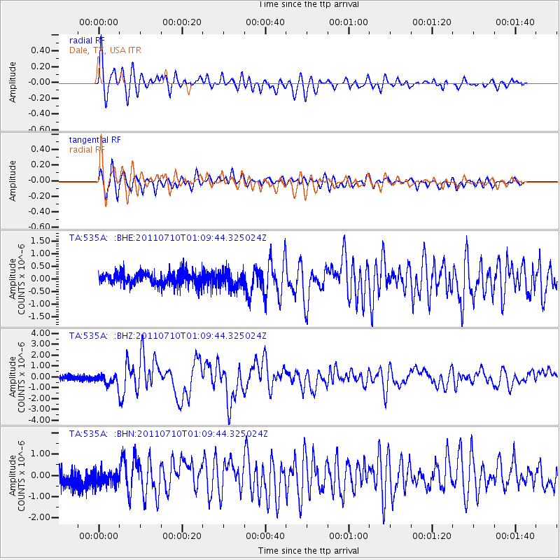
Earthquake location: Off East Coast Of Honshu, Japan
Earthquake latitude/longitude: 38.0/143.3
Earthquake time(UTC): 2011/07/10 (191) 00:57:10 GMT
Earthquake Depth: 23 km
Earthquake Magnitude: 6.6 MB, 7.0 MS, 7.0 MW, 7.0 MW
Earthquake Catalog/Contributor: WHDF/NEIC
Network: TA USArray Transportable Network (new EarthScope stations)
Station: 535A Dale, TX, USA
Lat/Lon: 30.03 N/97.57 W
Elevation: 170 m
Distance: 91.6 deg
Az: 49.251 deg
Baz: 316.385 deg
Ray Param: 0.04157808
Estimated Moho Depth: 34.5 km
Estimated Crust Vp/Vs: 1.60
Assumed Crust Vp: 6.347 km/s
Estimated Crust Vs: 3.967 km/s
Estimated Crust Poisson's Ratio: 0.18
Radial Match: 93.429756 %
Radial Bump: 400
Transverse Match: 88.00719 %
Transverse Bump: 400
SOD ConfigId: 395004
Insert Time: 2011-12-16 06:36:32.272 +0000
GWidth: 2.5
Max Bumps: 400
Tol: 0.001

Signal To Noise

ChannelStoNSTALTA
TA:535A: :BHZ:20110710T01:09:44.325024Z3.04930645.2582607E-71.7244119E-7
TA:535A: :BHN:20110710T01:09:44.325024Z1.18282163.1867734E-72.694213E-7
TA:535A: :BHE:20110710T01:09:44.325024Z1.33117083.187918E-72.3948226E-7
Arrivals
Ps3.3 SECOND
PpPs14 SECOND
PsPs/PpSs17 SECOND