336A Riesel, TX, USA - Earthquake Result Viewer
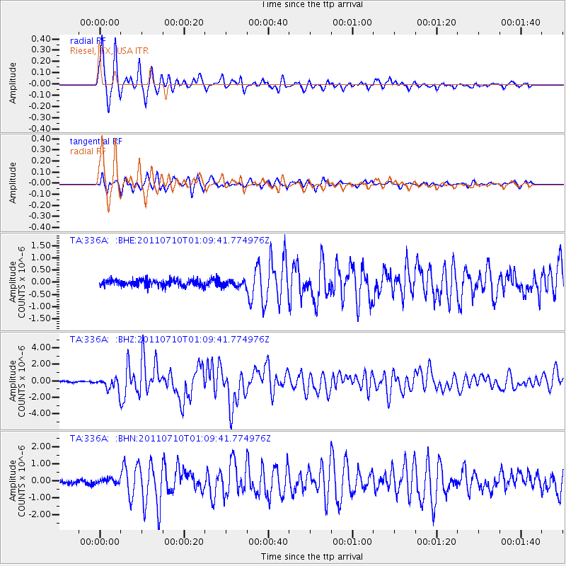
Earthquake location: Off East Coast Of Honshu, Japan
Earthquake latitude/longitude: 38.0/143.3
Earthquake time(UTC): 2011/07/10 (191) 00:57:10 GMT
Earthquake Depth: 23 km
Earthquake Magnitude: 6.6 MB, 7.0 MS, 7.0 MW, 7.0 MW
Earthquake Catalog/Contributor: WHDF/NEIC
Network: TA USArray Transportable Network (new EarthScope stations)
Station: 336A Riesel, TX, USA
Lat/Lon: 31.39 N/96.84 W
Elevation: 140 m
Distance: 91.1 deg
Az: 47.866 deg
Baz: 316.787 deg
Ray Param: 0.04162659
Estimated Moho Depth: 10.0 km
Estimated Crust Vp/Vs: 1.60
Assumed Crust Vp: 6.347 km/s
Estimated Crust Vs: 3.967 km/s
Estimated Crust Poisson's Ratio: 0.18
Radial Match: 96.15898 %
Radial Bump: 341
Transverse Match: 90.5908 %
Transverse Bump: 400
SOD ConfigId: 395004
Insert Time: 2011-12-16 06:38:08.558 +0000
GWidth: 2.5
Max Bumps: 400
Tol: 0.001

Signal To Noise

ChannelStoNSTALTA
TA:336A: :BHZ:20110710T01:09:41.774976Z9.4339398.0102524E-78.490888E-8
TA:336A: :BHN:20110710T01:09:41.774976Z0.951787351.2790609E-71.3438515E-7
TA:336A: :BHE:20110710T01:09:41.774976Z1.0312811.3276414E-71.2873711E-7
Arrivals
Ps1.0 SECOND
PpPs4.0 SECOND
PsPs/PpSs5.0 SECOND