338A Crockett, TX, USA - Earthquake Result Viewer
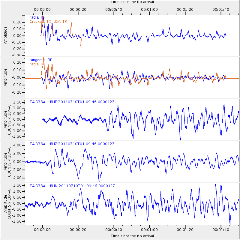
Earthquake location: Off East Coast Of Honshu, Japan
Earthquake latitude/longitude: 38.0/143.3
Earthquake time(UTC): 2011/07/10 (191) 00:57:10 GMT
Earthquake Depth: 23 km
Earthquake Magnitude: 6.6 MB, 7.0 MS, 7.0 MW, 7.0 MW
Earthquake Catalog/Contributor: WHDF/NEIC
Network: TA USArray Transportable Network (new EarthScope stations)
Station: 338A Crockett, TX, USA
Lat/Lon: 31.36 N/95.31 W
Elevation: 137 m
Distance: 92.0 deg
Az: 46.924 deg
Baz: 317.606 deg
Ray Param: 0.04152344
Estimated Moho Depth: 27.25 km
Estimated Crust Vp/Vs: 2.10
Assumed Crust Vp: 5.738 km/s
Estimated Crust Vs: 2.736 km/s
Estimated Crust Poisson's Ratio: 0.35
Radial Match: 89.24619 %
Radial Bump: 400
Transverse Match: 80.053795 %
Transverse Bump: 400
SOD ConfigId: 395004
Insert Time: 2011-12-16 06:38:38.407 +0000
GWidth: 2.5
Max Bumps: 400
Tol: 0.001

Signal To Noise

ChannelStoNSTALTA
TA:338A: :BHZ:20110710T01:09:46.000012Z2.208263.300922E-71.4948067E-7
TA:338A: :BHN:20110710T01:09:46.000012Z1.56399881.3296503E-78.501607E-8
TA:338A: :BHE:20110710T01:09:46.000012Z0.6721771.2196196E-71.8144321E-7
Arrivals
Ps5.3 SECOND
PpPs15 SECOND
PsPs/PpSs20 SECOND