
340A Bronson, TX, USA - Earthquake Result Viewer
| ||||||||||||||||||
| ||||||||||||||||||
| ||||||||||||||||||
|
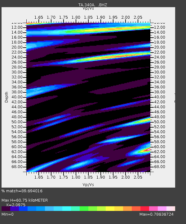
Signal To Noise
| Channel | StoN | STA | LTA |
| TA:340A: :BHZ:20110710T01:09:49.550Z | 5.6153083 | 4.8014476E-7 | 8.550639E-8 |
| TA:340A: :BHN:20110710T01:09:49.550Z | 1.380334 | 1.3305188E-7 | 9.639108E-8 |
| TA:340A: :BHE:20110710T01:09:49.550Z | 1.2788762 | 1.6411832E-7 | 1.283301E-7 |
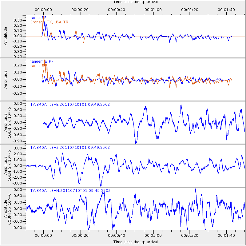
| Arrivals | |
| Ps | 11 SECOND |
| PpPs | 31 SECOND |
| PsPs/PpSs | 42 SECOND |

