239A Gary, TX, USA - Earthquake Result Viewer
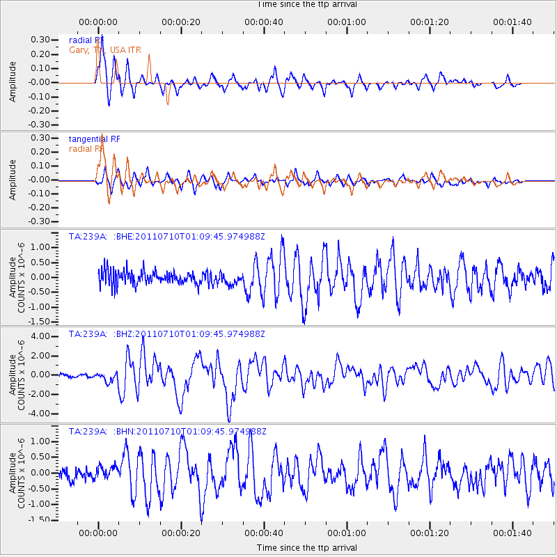
Earthquake location: Off East Coast Of Honshu, Japan
Earthquake latitude/longitude: 38.0/143.3
Earthquake time(UTC): 2011/07/10 (191) 00:57:10 GMT
Earthquake Depth: 23 km
Earthquake Magnitude: 6.6 MB, 7.0 MS, 7.0 MW, 7.0 MW
Earthquake Catalog/Contributor: WHDF/NEIC
Network: TA USArray Transportable Network (new EarthScope stations)
Station: 239A Gary, TX, USA
Lat/Lon: 32.02 N/94.47 W
Elevation: 100 m
Distance: 92.0 deg
Az: 45.95 deg
Baz: 318.079 deg
Ray Param: 0.041524667
Estimated Moho Depth: 17.5 km
Estimated Crust Vp/Vs: 1.60
Assumed Crust Vp: 6.245 km/s
Estimated Crust Vs: 3.897 km/s
Estimated Crust Poisson's Ratio: 0.18
Radial Match: 91.74293 %
Radial Bump: 373
Transverse Match: 84.68173 %
Transverse Bump: 400
SOD ConfigId: 395004
Insert Time: 2011-12-16 06:38:54.176 +0000
GWidth: 2.5
Max Bumps: 400
Tol: 0.001

Signal To Noise

ChannelStoNSTALTA
TA:239A: :BHZ:20110710T01:09:45.974988Z3.31087114.9118944E-71.4835656E-7
TA:239A: :BHN:20110710T01:09:45.974988Z1.14474492.0538968E-71.7941962E-7
TA:239A: :BHE:20110710T01:09:45.974988Z0.81996091.804357E-72.2005405E-7
Arrivals
Ps1.7 SECOND
PpPs7.1 SECOND
PsPs/PpSs8.9 SECOND