
O36A Bolckow, MO, USA - Earthquake Result Viewer
| ||||||||||||||||||
| ||||||||||||||||||
| ||||||||||||||||||
|
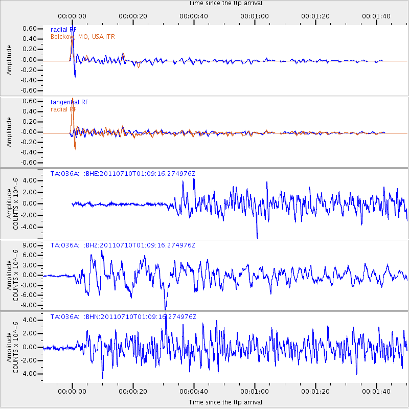
Signal To Noise
| Channel | StoN | STA | LTA |
| TA:O36A: :BHZ:20110710T01:09:16.274976Z | 16.880226 | 1.8682482E-6 | 1.1067673E-7 |
| TA:O36A: :BHN:20110710T01:09:16.274976Z | 4.5036483 | 5.657276E-7 | 1.2561541E-7 |
| TA:O36A: :BHE:20110710T01:09:16.274976Z | 4.4638324 | 6.093565E-7 | 1.3650971E-7 |
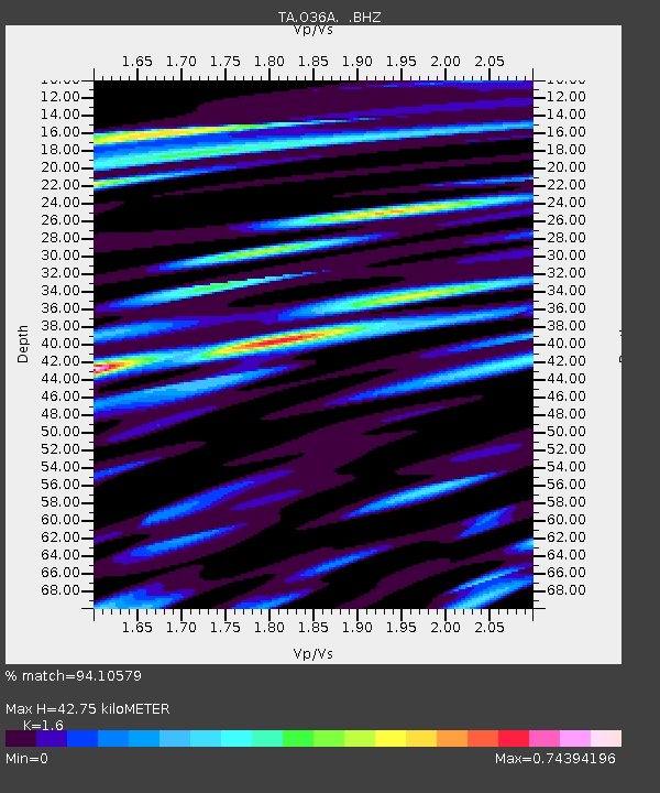
| Arrivals | |
| Ps | 4.1 SECOND |
| PpPs | 17 SECOND |
| PsPs/PpSs | 21 SECOND |

