O34A Beatrice, NE, USA - Earthquake Result Viewer
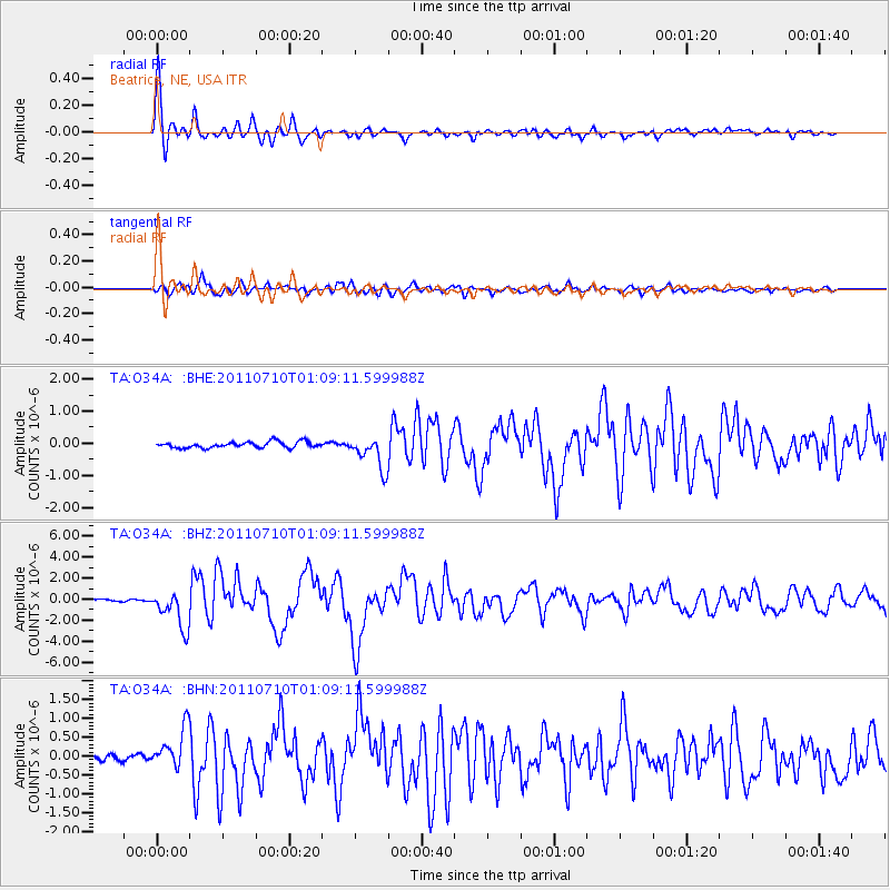
Earthquake location: Off East Coast Of Honshu, Japan
Earthquake latitude/longitude: 38.0/143.3
Earthquake time(UTC): 2011/07/10 (191) 00:57:10 GMT
Earthquake Depth: 23 km
Earthquake Magnitude: 6.6 MB, 7.0 MS, 7.0 MW, 7.0 MW
Earthquake Catalog/Contributor: WHDF/NEIC
Network: TA USArray Transportable Network (new EarthScope stations)
Station: O34A Beatrice, NE, USA
Lat/Lon: 40.18 N/96.69 W
Elevation: 409 m
Distance: 84.8 deg
Az: 41.758 deg
Baz: 316.651 deg
Ray Param: 0.04523374
Estimated Moho Depth: 36.75 km
Estimated Crust Vp/Vs: 1.99
Assumed Crust Vp: 6.498 km/s
Estimated Crust Vs: 3.261 km/s
Estimated Crust Poisson's Ratio: 0.33
Radial Match: 95.13582 %
Radial Bump: 400
Transverse Match: 89.12041 %
Transverse Bump: 400
SOD ConfigId: 395004
Insert Time: 2011-12-16 06:44:50.556 +0000
GWidth: 2.5
Max Bumps: 400
Tol: 0.001

Signal To Noise

ChannelStoNSTALTA
TA:O34A: :BHZ:20110710T01:09:11.599988Z20.3469641.8153779E-68.9221075E-8
TA:O34A: :BHN:20110710T01:09:11.599988Z6.76681665.216582E-77.709064E-8
TA:O34A: :BHE:20110710T01:09:11.599988Z5.42981245.135877E-79.458664E-8
Arrivals
Ps5.7 SECOND
PpPs17 SECOND
PsPs/PpSs22 SECOND