U35A Pawnee, OK, USA - Earthquake Result Viewer
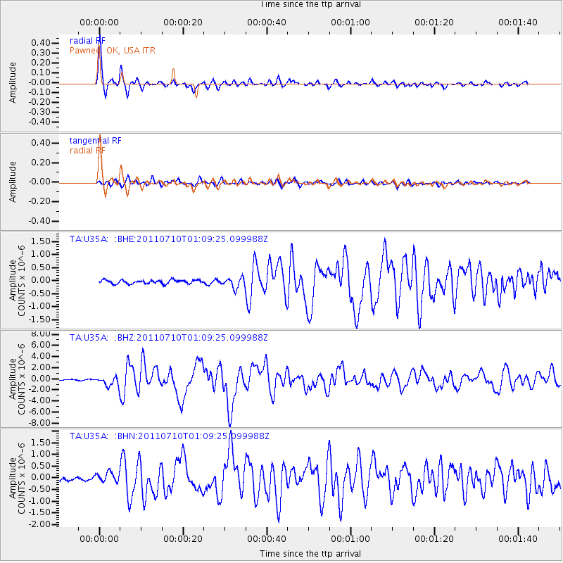
Earthquake location: Off East Coast Of Honshu, Japan
Earthquake latitude/longitude: 38.0/143.3
Earthquake time(UTC): 2011/07/10 (191) 00:57:10 GMT
Earthquake Depth: 23 km
Earthquake Magnitude: 6.6 MB, 7.0 MS, 7.0 MW, 7.0 MW
Earthquake Catalog/Contributor: WHDF/NEIC
Network: TA USArray Transportable Network (new EarthScope stations)
Station: U35A Pawnee, OK, USA
Lat/Lon: 36.37 N/96.73 W
Elevation: 303 m
Distance: 87.5 deg
Az: 44.395 deg
Baz: 316.806 deg
Ray Param: 0.04325776
Estimated Moho Depth: 41.75 km
Estimated Crust Vp/Vs: 1.79
Assumed Crust Vp: 6.483 km/s
Estimated Crust Vs: 3.632 km/s
Estimated Crust Poisson's Ratio: 0.27
Radial Match: 96.57106 %
Radial Bump: 369
Transverse Match: 85.91283 %
Transverse Bump: 400
SOD ConfigId: 395004
Insert Time: 2011-12-16 06:45:49.498 +0000
GWidth: 2.5
Max Bumps: 400
Tol: 0.001

Signal To Noise

ChannelStoNSTALTA
TA:U35A: :BHZ:20110710T01:09:25.099988Z11.800578.863518E-77.511093E-8
TA:U35A: :BHN:20110710T01:09:25.099988Z2.36655622.0597427E-78.7035446E-8
TA:U35A: :BHE:20110710T01:09:25.099988Z2.8751911.9462357E-76.769066E-8
Arrivals
Ps5.2 SECOND
PpPs18 SECOND
PsPs/PpSs23 SECOND