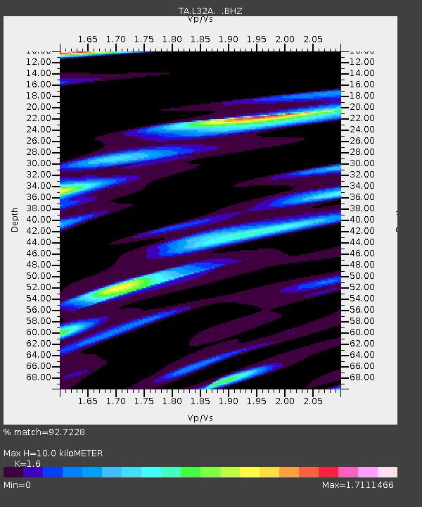
L32A Elgin, NE, USA - Earthquake Result Viewer

Earthquake location: Off East Coast Of Honshu, Japan
Earthquake latitude/longitude: 38.0/143.3
Earthquake time(UTC): 2011/07/10 (191) 00:57:10 GMT
Earthquake Depth: 23 km
Earthquake Magnitude: 6.6 MB, 7.0 MS, 7.0 MW, 7.0 MW
Earthquake Catalog/Contributor: WHDF/NEIC
Network: TA USArray Transportable Network (new EarthScope stations)
Station: L32A Elgin, NE, USA
Lat/Lon: 42.00 N/98.01 W
Elevation: 586 m
Distance: 82.8 deg
Az: 41.212 deg
Baz: 315.731 deg
Ray Param: 0.046646114
Estimated Moho Depth: 10.0 km
Estimated Crust Vp/Vs: 1.60
Assumed Crust Vp: 6.53 km/s
Estimated Crust Vs: 4.082 km/s
Estimated Crust Poisson's Ratio: 0.18
Radial Match: 92.7228 %
Radial Bump: 400
Transverse Match: 88.69087 %
Transverse Bump: 400
SOD ConfigId: 395004
Insert Time: 2011-12-16 06:46:09.850 +0000
GWidth: 2.5
Max Bumps: 400
Tol: 0.001

Signal To Noise

ChannelStoNSTALTA
TA:L32A: :BHZ:20110710T01:09:01.399976Z14.7465362.1608614E-61.465335E-7
TA:L32A: :BHN:20110710T01:09:01.399976Z2.8949437.3893324E-72.552497E-7
TA:L32A: :BHE:20110710T01:09:01.399976Z3.14655787.17247E-72.2794656E-7
Arrivals
Ps0.9 SECOND
PpPs3.9 SECOND
PsPs/PpSs4.8 SECOND