K33A Hardington, NE, USA - Earthquake Result Viewer
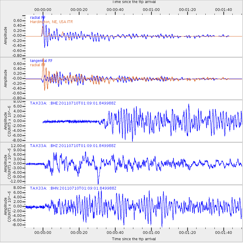
Earthquake location: Off East Coast Of Honshu, Japan
Earthquake latitude/longitude: 38.0/143.3
Earthquake time(UTC): 2011/07/10 (191) 00:57:10 GMT
Earthquake Depth: 23 km
Earthquake Magnitude: 6.6 MB, 7.0 MS, 7.0 MW, 7.0 MW
Earthquake Catalog/Contributor: WHDF/NEIC
Network: TA USArray Transportable Network (new EarthScope stations)
Station: K33A Hardington, NE, USA
Lat/Lon: 42.61 N/97.00 W
Elevation: 507 m
Distance: 82.8 deg
Az: 40.25 deg
Baz: 316.285 deg
Ray Param: 0.046585754
Estimated Moho Depth: 20.0 km
Estimated Crust Vp/Vs: 2.10
Assumed Crust Vp: 6.498 km/s
Estimated Crust Vs: 3.098 km/s
Estimated Crust Poisson's Ratio: 0.35
Radial Match: 92.197205 %
Radial Bump: 400
Transverse Match: 84.51807 %
Transverse Bump: 400
SOD ConfigId: 395004
Insert Time: 2011-12-16 06:46:24.584 +0000
GWidth: 2.5
Max Bumps: 400
Tol: 0.001

Signal To Noise

ChannelStoNSTALTA
TA:K33A: :BHZ:20110710T01:09:01.849988Z10.9959372.167588E-61.9712625E-7
TA:K33A: :BHN:20110710T01:09:01.849988Z3.19960958.249192E-72.578187E-7
TA:K33A: :BHE:20110710T01:09:01.849988Z4.0787719.58471E-72.3499014E-7
Arrivals
Ps3.5 SECOND
PpPs9.3 SECOND
PsPs/PpSs13 SECOND