
K34A Le Mars, IA, USA - Earthquake Result Viewer
| ||||||||||||||||||
| ||||||||||||||||||
| ||||||||||||||||||
|
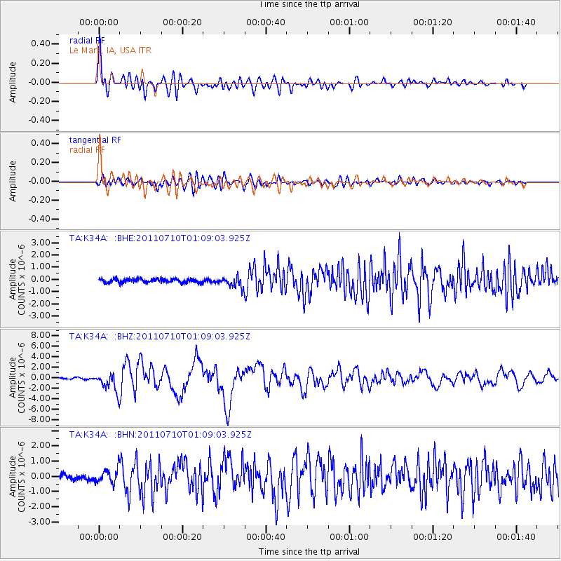
Signal To Noise
| Channel | StoN | STA | LTA |
| TA:K34A: :BHZ:20110710T01:09:03.925Z | 18.070171 | 1.8268911E-6 | 1.0109982E-7 |
| TA:K34A: :BHN:20110710T01:09:03.925Z | 3.2347918 | 4.7300793E-7 | 1.4622516E-7 |
| TA:K34A: :BHE:20110710T01:09:03.925Z | 2.8847814 | 4.369345E-7 | 1.514619E-7 |
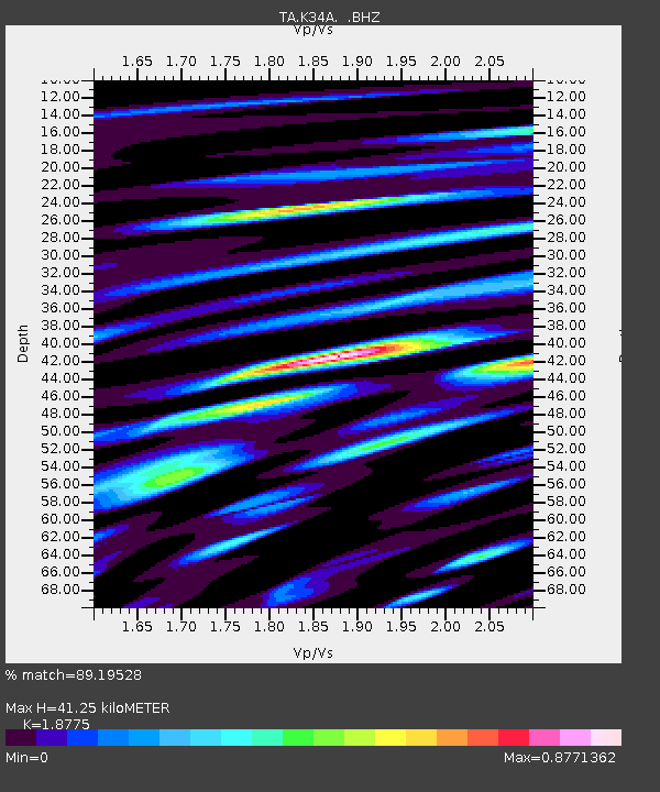
| Arrivals | |
| Ps | 5.7 SECOND |
| PpPs | 18 SECOND |
| PsPs/PpSs | 24 SECOND |

