J33A Davis, SD, USA - Earthquake Result Viewer
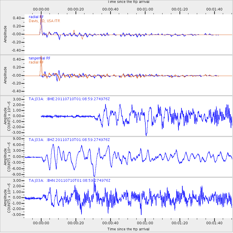
Earthquake location: Off East Coast Of Honshu, Japan
Earthquake latitude/longitude: 38.0/143.3
Earthquake time(UTC): 2011/07/10 (191) 00:57:10 GMT
Earthquake Depth: 23 km
Earthquake Magnitude: 6.6 MB, 7.0 MS, 7.0 MW, 7.0 MW
Earthquake Catalog/Contributor: WHDF/NEIC
Network: TA USArray Transportable Network (new EarthScope stations)
Station: J33A Davis, SD, USA
Lat/Lon: 43.32 N/96.97 W
Elevation: 400 m
Distance: 82.3 deg
Az: 39.735 deg
Baz: 316.242 deg
Ray Param: 0.04693117
Estimated Moho Depth: 17.75 km
Estimated Crust Vp/Vs: 2.00
Assumed Crust Vp: 6.498 km/s
Estimated Crust Vs: 3.249 km/s
Estimated Crust Poisson's Ratio: 0.33
Radial Match: 97.20483 %
Radial Bump: 400
Transverse Match: 90.511375 %
Transverse Bump: 400
SOD ConfigId: 395004
Insert Time: 2011-12-16 06:47:09.826 +0000
GWidth: 2.5
Max Bumps: 400
Tol: 0.001

Signal To Noise

ChannelStoNSTALTA
TA:J33A: :BHZ:20110710T01:08:59.274976Z24.8546221.9407316E-67.8083325E-8
TA:J33A: :BHN:20110710T01:08:59.274976Z5.01933244.4576447E-78.8809514E-8
TA:J33A: :BHE:20110710T01:08:59.274976Z6.53918084.842359E-77.4051464E-8
Arrivals
Ps2.8 SECOND
PpPs8.0 SECOND
PsPs/PpSs11 SECOND