L04D Klamath Falls, OR, USA - Earthquake Result Viewer
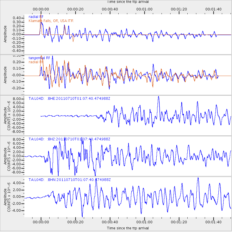
Earthquake location: Off East Coast Of Honshu, Japan
Earthquake latitude/longitude: 38.0/143.3
Earthquake time(UTC): 2011/07/10 (191) 00:57:10 GMT
Earthquake Depth: 23 km
Earthquake Magnitude: 6.6 MB, 7.0 MS, 7.0 MW, 7.0 MW
Earthquake Catalog/Contributor: WHDF/NEIC
Network: TA USArray Transportable Network (new EarthScope stations)
Station: L04D Klamath Falls, OR, USA
Lat/Lon: 42.22 N/122.30 W
Elevation: 1437 m
Distance: 68.6 deg
Az: 52.716 deg
Baz: 302.244 deg
Ray Param: 0.05619321
Estimated Moho Depth: 38.5 km
Estimated Crust Vp/Vs: 1.84
Assumed Crust Vp: 6.522 km/s
Estimated Crust Vs: 3.544 km/s
Estimated Crust Poisson's Ratio: 0.29
Radial Match: 87.21599 %
Radial Bump: 400
Transverse Match: 90.408775 %
Transverse Bump: 400
SOD ConfigId: 395004
Insert Time: 2011-12-16 06:47:54.174 +0000
GWidth: 2.5
Max Bumps: 400
Tol: 0.001

Signal To Noise

ChannelStoNSTALTA
TA:L04D: :BHZ:20110710T01:07:40.474988Z8.73024751.3240556E-61.51663E-7
TA:L04D: :BHN:20110710T01:07:40.474988Z2.05636053.305515E-71.607459E-7
TA:L04D: :BHE:20110710T01:07:40.474988Z2.44175534.7067886E-71.927625E-7
Arrivals
Ps5.2 SECOND
PpPs16 SECOND
PsPs/PpSs21 SECOND