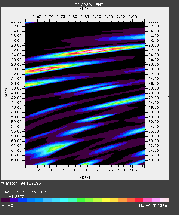
O03D Paynes Creek, CA, USA - Earthquake Result Viewer
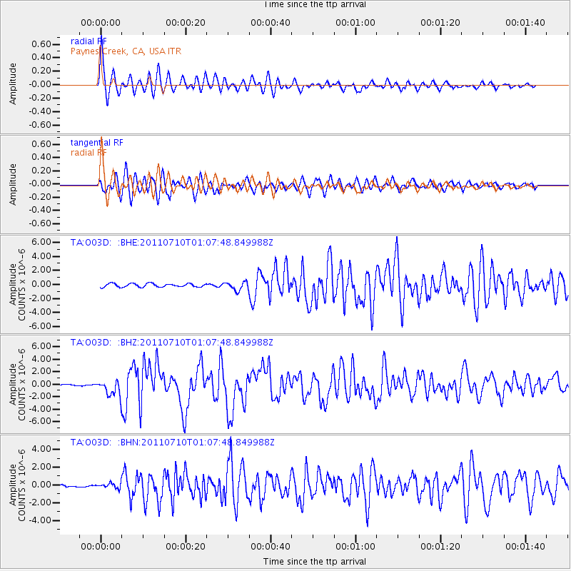
Earthquake location: Off East Coast Of Honshu, Japan
Earthquake latitude/longitude: 38.0/143.3
Earthquake time(UTC): 2011/07/10 (191) 00:57:10 GMT
Earthquake Depth: 23 km
Earthquake Magnitude: 6.6 MB, 7.0 MS, 7.0 MW, 7.0 MW
Earthquake Catalog/Contributor: WHDF/NEIC
Network: TA USArray Transportable Network (new EarthScope stations)
Station: O03D Paynes Creek, CA, USA
Lat/Lon: 40.29 N/121.80 W
Elevation: 968 m
Distance: 69.9 deg
Az: 54.227 deg
Baz: 303.11 deg
Ray Param: 0.05529799
Estimated Moho Depth: 22.25 km
Estimated Crust Vp/Vs: 1.88
Assumed Crust Vp: 6.566 km/s
Estimated Crust Vs: 3.497 km/s
Estimated Crust Poisson's Ratio: 0.30
Radial Match: 94.119095 %
Radial Bump: 400
Transverse Match: 88.47414 %
Transverse Bump: 400
SOD ConfigId: 395004
Insert Time: 2011-12-16 06:48:22.452 +0000
GWidth: 2.5
Max Bumps: 400
Tol: 0.001

Signal To Noise

ChannelStoNSTALTA
TA:O03D: :BHZ:20110710T01:07:48.849988Z12.200571.2982867E-61.06411974E-7
TA:O03D: :BHN:20110710T01:07:48.849988Z1.65665972.8927525E-71.7461355E-7
TA:O03D: :BHE:20110710T01:07:48.849988Z2.46385676.035363E-72.4495594E-7
Arrivals
Ps3.1 SECOND
PpPs9.4 SECOND
PsPs/PpSs12 SECOND