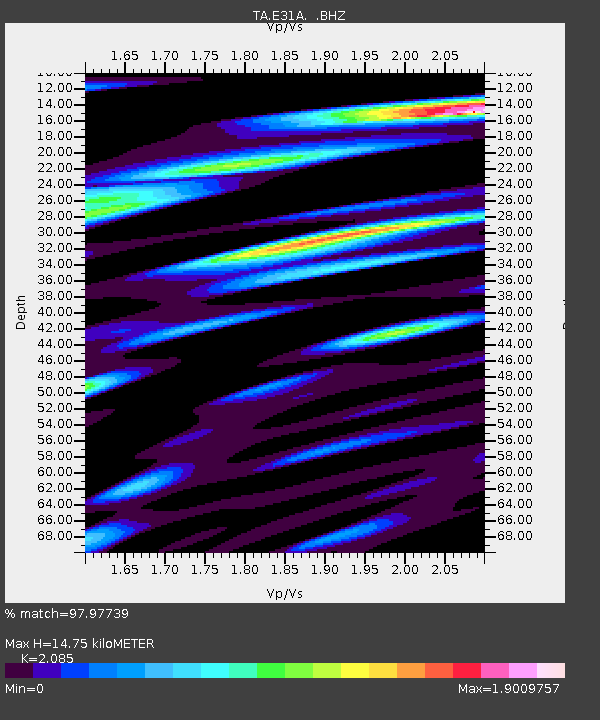
E31A Nome, ND, USA - Earthquake Result Viewer
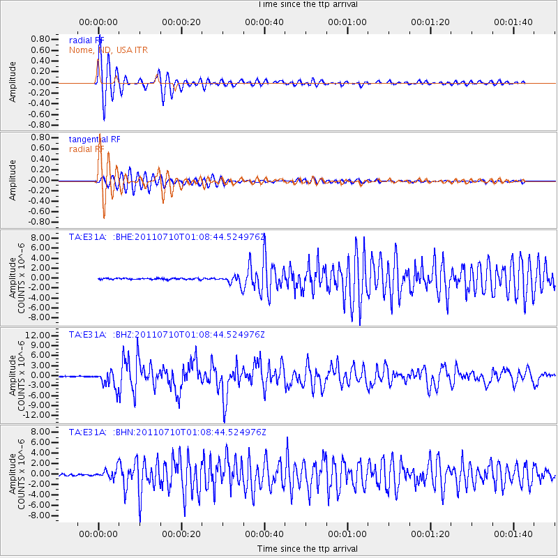
Earthquake location: Off East Coast Of Honshu, Japan
Earthquake latitude/longitude: 38.0/143.3
Earthquake time(UTC): 2011/07/10 (191) 00:57:10 GMT
Earthquake Depth: 23 km
Earthquake Magnitude: 6.6 MB, 7.0 MS, 7.0 MW, 7.0 MW
Earthquake Catalog/Contributor: WHDF/NEIC
Network: TA USArray Transportable Network (new EarthScope stations)
Station: E31A Nome, ND, USA
Lat/Lon: 46.56 N/97.89 W
Elevation: 427 m
Distance: 79.6 deg
Az: 37.922 deg
Baz: 315.308 deg
Ray Param: 0.048851114
Estimated Moho Depth: 14.75 km
Estimated Crust Vp/Vs: 2.09
Assumed Crust Vp: 6.498 km/s
Estimated Crust Vs: 3.116 km/s
Estimated Crust Poisson's Ratio: 0.35
Radial Match: 97.97739 %
Radial Bump: 315
Transverse Match: 93.79893 %
Transverse Bump: 400
SOD ConfigId: 395004
Insert Time: 2011-12-16 06:49:38.942 +0000
GWidth: 2.5
Max Bumps: 400
Tol: 0.001

Signal To Noise

ChannelStoNSTALTA
TA:E31A: :BHZ:20110710T01:08:44.524976Z22.5186652.556825E-61.1354248E-7
TA:E31A: :BHN:20110710T01:08:44.524976Z5.46883259.5226187E-71.7412526E-7
TA:E31A: :BHE:20110710T01:08:44.524976Z8.443641.0245202E-61.2133633E-7
Arrivals
Ps2.5 SECOND
PpPs6.8 SECOND
PsPs/PpSs9.4 SECOND