E34A Wadena, MN, USA - Earthquake Result Viewer
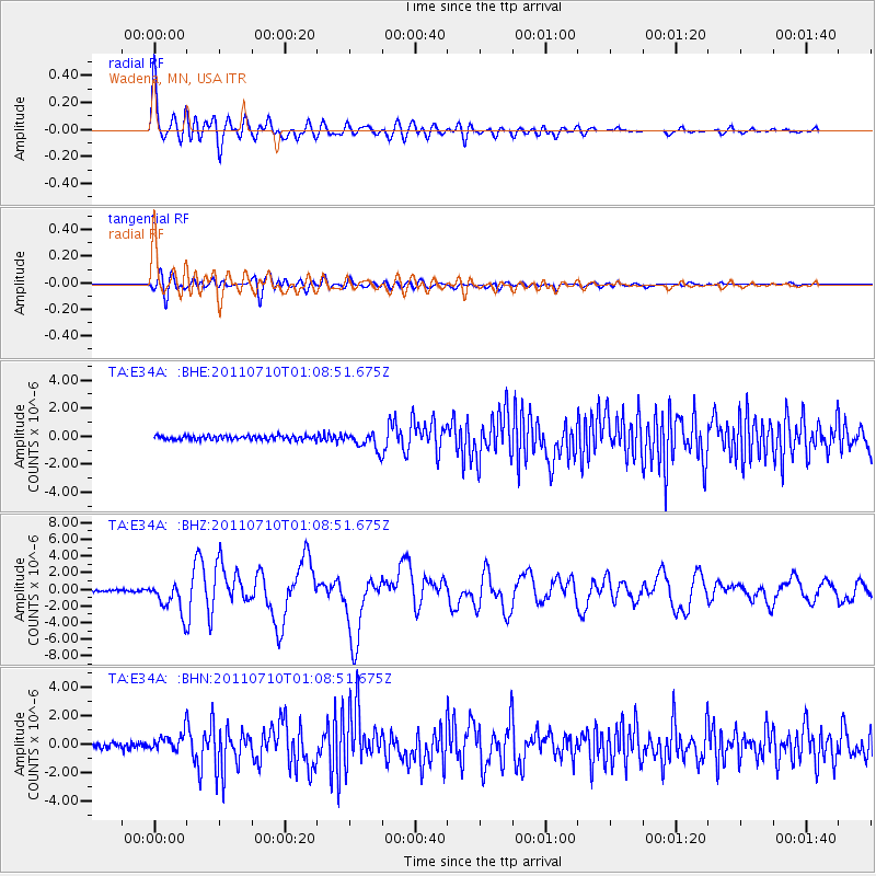
Earthquake location: Off East Coast Of Honshu, Japan
Earthquake latitude/longitude: 38.0/143.3
Earthquake time(UTC): 2011/07/10 (191) 00:57:10 GMT
Earthquake Depth: 23 km
Earthquake Magnitude: 6.6 MB, 7.0 MS, 7.0 MW, 7.0 MW
Earthquake Catalog/Contributor: WHDF/NEIC
Network: TA USArray Transportable Network (new EarthScope stations)
Station: E34A Wadena, MN, USA
Lat/Lon: 46.51 N/95.17 W
Elevation: 430 m
Distance: 80.9 deg
Az: 36.579 deg
Baz: 317.048 deg
Ray Param: 0.047943547
Estimated Moho Depth: 42.75 km
Estimated Crust Vp/Vs: 1.73
Assumed Crust Vp: 6.419 km/s
Estimated Crust Vs: 3.705 km/s
Estimated Crust Poisson's Ratio: 0.25
Radial Match: 90.38411 %
Radial Bump: 400
Transverse Match: 57.003933 %
Transverse Bump: 400
SOD ConfigId: 395004
Insert Time: 2011-12-16 06:51:27.368 +0000
GWidth: 2.5
Max Bumps: 400
Tol: 0.001

Signal To Noise

ChannelStoNSTALTA
TA:E34A: :BHZ:20110710T01:08:51.675Z21.3288361.8686055E-68.760935E-8
TA:E34A: :BHN:20110710T01:08:51.675Z4.12657366.2287495E-71.509424E-7
TA:E34A: :BHE:20110710T01:08:51.675Z4.1343486.0993733E-71.4752926E-7
Arrivals
Ps5.0 SECOND
PpPs18 SECOND
PsPs/PpSs23 SECOND