You are here: Home > Network List > UW - Pacific Northwest Regional Seismic Network Stations List
> Station UMAT Pilot Rock, OR, USA > Earthquake Result Viewer
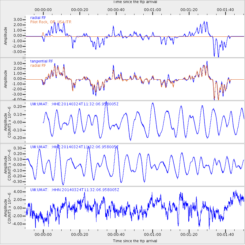
UMAT Pilot Rock, OR, USA - Earthquake Result Viewer
*The percent match for this event was below the threshold and hence no stack was calculated.
| Earthquake location: |
Near Coast Of Nicaragua |
| Earthquake latitude/longitude: |
11.7/-87.0 |
| Earthquake time(UTC): |
2014/03/24 (083) 11:24:42 GMT |
| Earthquake Depth: |
61 km |
| Earthquake Magnitude: |
4.5 mb |
| Earthquake Catalog/Contributor: |
ISC/ISC |
|
| Network: |
UW Pacific Northwest Regional Seismic Network |
| Station: |
UMAT Pilot Rock, OR, USA |
| Lat/Lon: |
45.29 N/118.96 W |
| Elevation: |
1318 m |
|
| Distance: |
43.1 deg |
| Az: |
326.89 deg |
| Baz: |
130.722 deg |
| Ray Param: |
$rayparam |
*The percent match for this event was below the threshold and hence was not used in the summary stack. |
|
| Radial Match: |
27.452202 % |
| Radial Bump: |
400 |
| Transverse Match: |
27.617552 % |
| Transverse Bump: |
400 |
| SOD ConfigId: |
3390531 |
| Insert Time: |
2019-04-10 21:04:35.007 +0000 |
| GWidth: |
2.5 |
| Max Bumps: |
400 |
| Tol: |
0.001 |
|
Signal To Noise
| Channel | StoN | STA | LTA |
| UW:UMAT: :HHZ:20140324T11:32:06.958005Z | 0.6651193 | 9.726727E-8 | 1.4624032E-7 |
| UW:UMAT: :HHN:20140324T11:32:06.958005Z | 1.439549 | 3.2844105E-6 | 2.2815555E-6 |
| UW:UMAT: :HHE:20140324T11:32:06.958005Z | 1.694669 | 1.5251373E-7 | 8.9996185E-8 |
| Arrivals |
| Ps | |
| PpPs | |
| PsPs/PpSs | |


