K37A Belmond, IA, USA - Earthquake Result Viewer
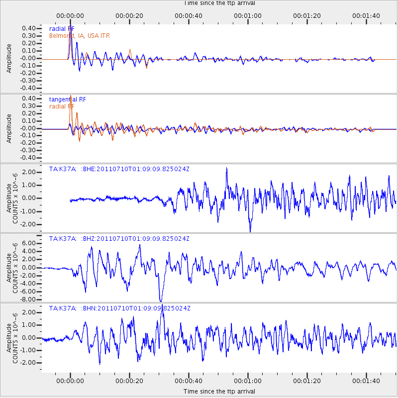
Earthquake location: Off East Coast Of Honshu, Japan
Earthquake latitude/longitude: 38.0/143.3
Earthquake time(UTC): 2011/07/10 (191) 00:57:10 GMT
Earthquake Depth: 23 km
Earthquake Magnitude: 6.6 MB, 7.0 MS, 7.0 MW, 7.0 MW
Earthquake Catalog/Contributor: WHDF/NEIC
Network: TA USArray Transportable Network (new EarthScope stations)
Station: K37A Belmond, IA, USA
Lat/Lon: 42.77 N/93.64 W
Elevation: 365 m
Distance: 84.4 deg
Az: 38.306 deg
Baz: 318.341 deg
Ray Param: 0.045486536
Estimated Moho Depth: 21.0 km
Estimated Crust Vp/Vs: 1.71
Assumed Crust Vp: 6.53 km/s
Estimated Crust Vs: 3.83 km/s
Estimated Crust Poisson's Ratio: 0.24
Radial Match: 96.35482 %
Radial Bump: 400
Transverse Match: 86.18395 %
Transverse Bump: 400
SOD ConfigId: 395004
Insert Time: 2011-12-16 06:55:25.190 +0000
GWidth: 2.5
Max Bumps: 400
Tol: 0.001

Signal To Noise

ChannelStoNSTALTA
TA:K37A: :BHZ:20110710T01:09:09.825024Z14.4889511.4947002E-61.03161376E-7
TA:K37A: :BHN:20110710T01:09:09.825024Z4.50443554.1604997E-79.236451E-8
TA:K37A: :BHE:20110710T01:09:09.825024Z2.98279072.4418094E-78.1863256E-8
Arrivals
Ps2.3 SECOND
PpPs8.5 SECOND
PsPs/PpSs11 SECOND