K36A Gilmore City, IA, USA - Earthquake Result Viewer
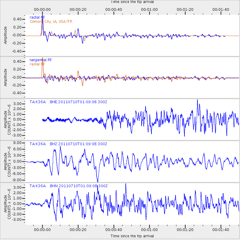
Earthquake location: Off East Coast Of Honshu, Japan
Earthquake latitude/longitude: 38.0/143.3
Earthquake time(UTC): 2011/07/10 (191) 00:57:10 GMT
Earthquake Depth: 23 km
Earthquake Magnitude: 6.6 MB, 7.0 MS, 7.0 MW, 7.0 MW
Earthquake Catalog/Contributor: WHDF/NEIC
Network: TA USArray Transportable Network (new EarthScope stations)
Station: K36A Gilmore City, IA, USA
Lat/Lon: 42.64 N/94.45 W
Elevation: 364 m
Distance: 84.1 deg
Az: 38.84 deg
Baz: 317.846 deg
Ray Param: 0.045699082
Estimated Moho Depth: 47.25 km
Estimated Crust Vp/Vs: 1.60
Assumed Crust Vp: 6.53 km/s
Estimated Crust Vs: 4.082 km/s
Estimated Crust Poisson's Ratio: 0.18
Radial Match: 94.04531 %
Radial Bump: 400
Transverse Match: 85.86997 %
Transverse Bump: 400
SOD ConfigId: 395004
Insert Time: 2011-12-16 06:55:27.146 +0000
GWidth: 2.5
Max Bumps: 400
Tol: 0.001

Signal To Noise

ChannelStoNSTALTA
TA:K36A: :BHZ:20110710T01:09:08.300Z11.8916291.7254789E-61.4510029E-7
TA:K36A: :BHN:20110710T01:09:08.300Z3.3094644.7073297E-71.4223843E-7
TA:K36A: :BHE:20110710T01:09:08.300Z2.40770774.652212E-71.9322164E-7
Arrivals
Ps4.5 SECOND
PpPs18 SECOND
PsPs/PpSs23 SECOND