F32A Veblen, SD, USA - Earthquake Result Viewer
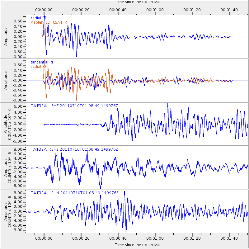
Earthquake location: Off East Coast Of Honshu, Japan
Earthquake latitude/longitude: 38.0/143.3
Earthquake time(UTC): 2011/07/10 (191) 00:57:10 GMT
Earthquake Depth: 23 km
Earthquake Magnitude: 6.6 MB, 7.0 MS, 7.0 MW, 7.0 MW
Earthquake Catalog/Contributor: WHDF/NEIC
Network: TA USArray Transportable Network (new EarthScope stations)
Station: F32A Veblen, SD, USA
Lat/Lon: 45.87 N/97.13 W
Elevation: 371 m
Distance: 80.4 deg
Az: 38.027 deg
Baz: 315.875 deg
Ray Param: 0.04826198
Estimated Moho Depth: 30.0 km
Estimated Crust Vp/Vs: 1.97
Assumed Crust Vp: 6.552 km/s
Estimated Crust Vs: 3.322 km/s
Estimated Crust Poisson's Ratio: 0.33
Radial Match: 89.15132 %
Radial Bump: 400
Transverse Match: 80.76336 %
Transverse Bump: 400
SOD ConfigId: 395004
Insert Time: 2011-12-16 06:56:31.767 +0000
GWidth: 2.5
Max Bumps: 400
Tol: 0.001

Signal To Noise

ChannelStoNSTALTA
TA:F32A: :BHZ:20110710T01:08:49.149976Z31.3870542.3091193E-67.356916E-8
TA:F32A: :BHN:20110710T01:08:49.149976Z5.16311937.91226E-71.5324574E-7
TA:F32A: :BHE:20110710T01:08:49.149976Z8.4078698.4878354E-71.00951084E-7
Arrivals
Ps4.6 SECOND
PpPs13 SECOND
PsPs/PpSs18 SECOND