O38A Galt, MO, USA - Earthquake Result Viewer
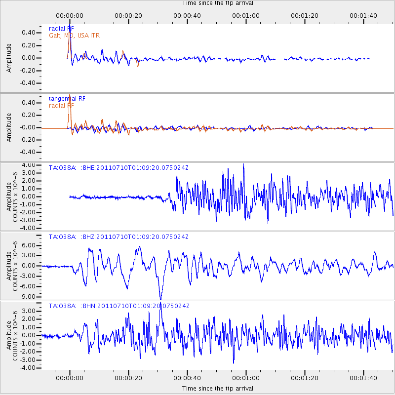
Earthquake location: Off East Coast Of Honshu, Japan
Earthquake latitude/longitude: 38.0/143.3
Earthquake time(UTC): 2011/07/10 (191) 00:57:10 GMT
Earthquake Depth: 23 km
Earthquake Magnitude: 6.6 MB, 7.0 MS, 7.0 MW, 7.0 MW
Earthquake Catalog/Contributor: WHDF/NEIC
Network: TA USArray Transportable Network (new EarthScope stations)
Station: O38A Galt, MO, USA
Lat/Lon: 40.12 N/93.47 W
Elevation: 266 m
Distance: 86.5 deg
Az: 39.971 deg
Baz: 318.583 deg
Ray Param: 0.044012614
Estimated Moho Depth: 24.25 km
Estimated Crust Vp/Vs: 2.04
Assumed Crust Vp: 6.498 km/s
Estimated Crust Vs: 3.193 km/s
Estimated Crust Poisson's Ratio: 0.34
Radial Match: 94.82163 %
Radial Bump: 400
Transverse Match: 77.762375 %
Transverse Bump: 400
SOD ConfigId: 395004
Insert Time: 2011-12-16 06:58:22.751 +0000
GWidth: 2.5
Max Bumps: 400
Tol: 0.001

Signal To Noise

ChannelStoNSTALTA
TA:O38A: :BHZ:20110710T01:09:20.075024Z12.5682681.3941126E-61.1092321E-7
TA:O38A: :BHN:20110710T01:09:20.075024Z3.7974623.8976137E-71.0263734E-7
TA:O38A: :BHE:20110710T01:09:20.075024Z3.75526123.149677E-78.3873715E-8
Arrivals
Ps3.9 SECOND
PpPs11 SECOND
PsPs/PpSs15 SECOND