
S40A Lebanon, MO, USA - Earthquake Result Viewer
| ||||||||||||||||||
| ||||||||||||||||||
| ||||||||||||||||||
|
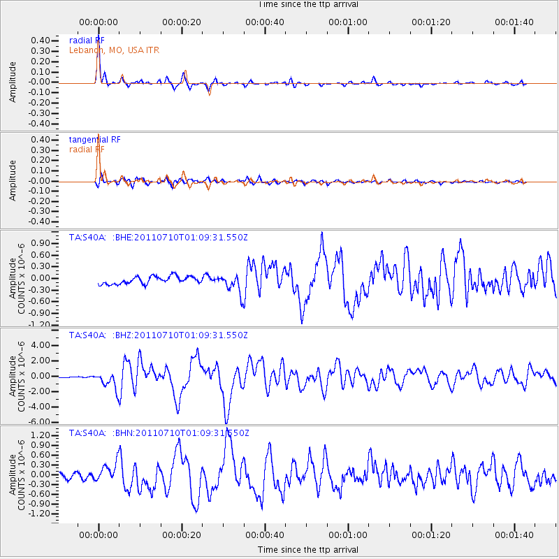
Signal To Noise
| Channel | StoN | STA | LTA |
| TA:S40A: :BHZ:20110710T01:09:31.550Z | 13.272411 | 1.1564288E-6 | 8.7130275E-8 |
| TA:S40A: :BHN:20110710T01:09:31.550Z | 2.6867101 | 2.6715026E-7 | 9.943397E-8 |
| TA:S40A: :BHE:20110710T01:09:31.550Z | 2.7308996 | 2.600946E-7 | 9.524137E-8 |
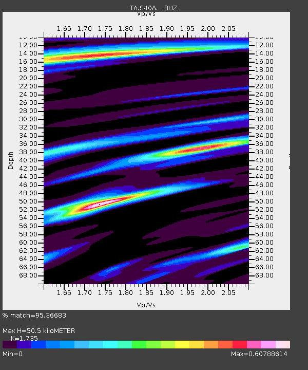
| Arrivals | |
| Ps | 5.8 SECOND |
| PpPs | 21 SECOND |
| PsPs/PpSs | 26 SECOND |

