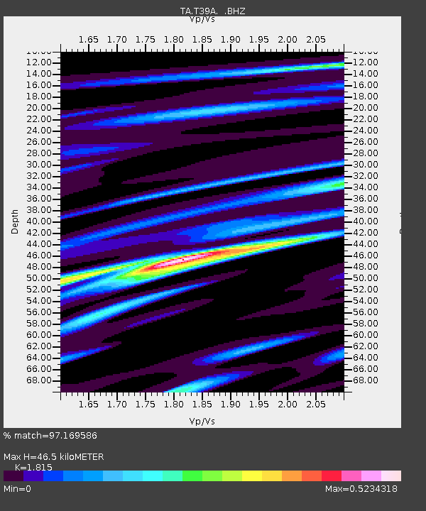
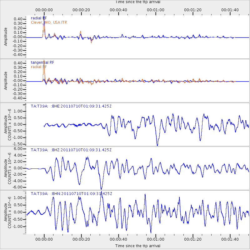
T39A Clever, MO, USA - Earthquake Result Viewer

Earthquake location: Off East Coast Of Honshu, Japan
Earthquake latitude/longitude: 38.0/143.3
Earthquake time(UTC): 2011/07/10 (191) 00:57:10 GMT
Earthquake Depth: 23 km
Earthquake Magnitude: 6.6 MB, 7.0 MS, 7.0 MW, 7.0 MW
Earthquake Catalog/Contributor: WHDF/NEIC
Network: TA USArray Transportable Network (new EarthScope stations)
Station: T39A Clever, MO, USA
Lat/Lon: 37.02 N/93.38 W
Elevation: 366 m
Distance: 88.8 deg
Az: 41.959 deg
Baz: 318.724 deg
Ray Param: 0.042268947
Estimated Moho Depth: 46.5 km
Estimated Crust Vp/Vs: 1.82
Assumed Crust Vp: 6.53 km/s
Estimated Crust Vs: 3.598 km/s
Estimated Crust Poisson's Ratio: 0.28
Radial Match: 97.169586 %
Radial Bump: 274
Transverse Match: 90.91808 %
Transverse Bump: 400
SOD ConfigId: 395004
Insert Time: 2011-12-16 06:59:41.053 +0000
GWidth: 2.5
Max Bumps: 400
Tol: 0.001

Signal To Noise

ChannelStoNSTALTA
TA:T39A: :BHZ:20110710T01:09:31.425Z13.223411.1674638E-68.8287656E-8
TA:T39A: :BHN:20110710T01:09:31.425Z4.98457433.730579E-77.484248E-8
TA:T39A: :BHE:20110710T01:09:31.425Z3.5696952.5954358E-77.270749E-8
Arrivals
Ps5.9 SECOND
PpPs20 SECOND
PsPs/PpSs26 SECOND