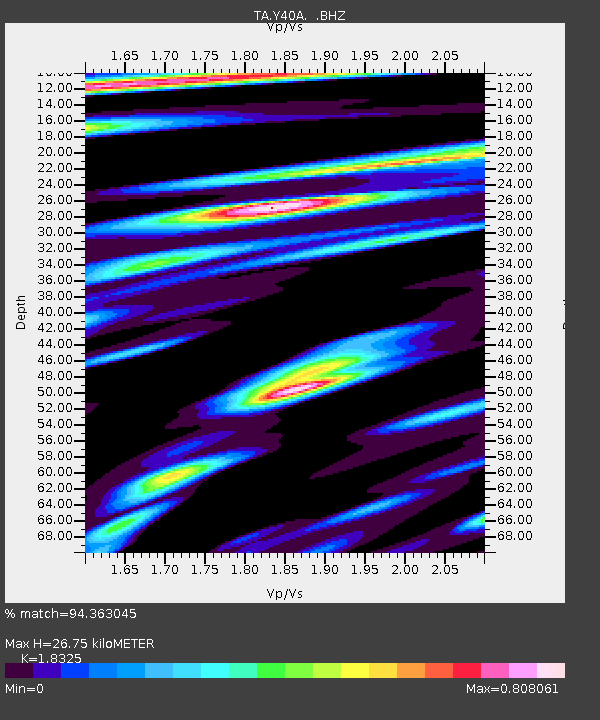
Y40A Okolona, AR, USA - Earthquake Result Viewer
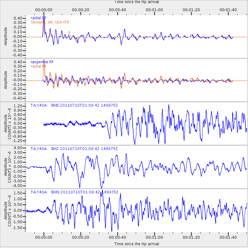
Earthquake location: Off East Coast Of Honshu, Japan
Earthquake latitude/longitude: 38.0/143.3
Earthquake time(UTC): 2011/07/10 (191) 00:57:10 GMT
Earthquake Depth: 23 km
Earthquake Magnitude: 6.6 MB, 7.0 MS, 7.0 MW, 7.0 MW
Earthquake Catalog/Contributor: WHDF/NEIC
Network: TA USArray Transportable Network (new EarthScope stations)
Station: Y40A Okolona, AR, USA
Lat/Lon: 34.01 N/93.28 W
Elevation: 117 m
Distance: 91.1 deg
Az: 43.881 deg
Baz: 318.781 deg
Ray Param: 0.04162079
Estimated Moho Depth: 26.75 km
Estimated Crust Vp/Vs: 1.83
Assumed Crust Vp: 6.498 km/s
Estimated Crust Vs: 3.546 km/s
Estimated Crust Poisson's Ratio: 0.29
Radial Match: 94.363045 %
Radial Bump: 400
Transverse Match: 86.032646 %
Transverse Bump: 400
SOD ConfigId: 395004
Insert Time: 2011-12-16 07:00:01.794 +0000
GWidth: 2.5
Max Bumps: 400
Tol: 0.001

Signal To Noise

ChannelStoNSTALTA
TA:Y40A: :BHZ:20110710T01:09:42.149976Z7.75103956.82766E-78.808702E-8
TA:Y40A: :BHN:20110710T01:09:42.149976Z3.08504151.631765E-75.2892805E-8
TA:Y40A: :BHE:20110710T01:09:42.149976Z1.86013471.3499462E-77.25725E-8
Arrivals
Ps3.5 SECOND
PpPs11 SECOND
PsPs/PpSs15 SECOND