
T38A Diamond, MO, USA - Earthquake Result Viewer
| ||||||||||||||||||
| ||||||||||||||||||
| ||||||||||||||||||
|
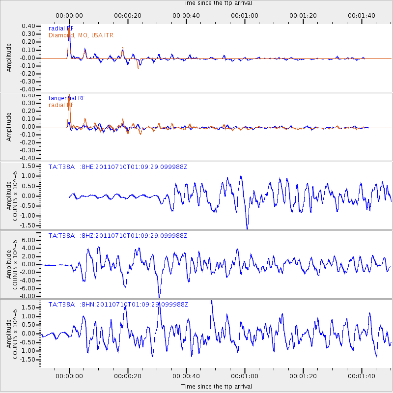
Signal To Noise
| Channel | StoN | STA | LTA |
| TA:T38A: :BHZ:20110710T01:09:29.099988Z | 18.792894 | 1.3025458E-6 | 6.9310545E-8 |
| TA:T38A: :BHN:20110710T01:09:29.099988Z | 6.1692004 | 3.7070532E-7 | 6.008969E-8 |
| TA:T38A: :BHE:20110710T01:09:29.099988Z | 3.3786738 | 2.3141781E-7 | 6.8493684E-8 |
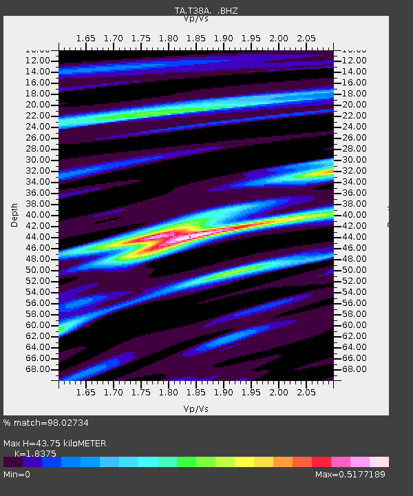
| Arrivals | |
| Ps | 5.7 SECOND |
| PpPs | 19 SECOND |
| PsPs/PpSs | 24 SECOND |

