You are here: Home > Network List > TA - USArray Transportable Network (new EarthScope stations) Stations List
> Station Y43A Makayla and Karen, Gunnison, MS, USA > Earthquake Result Viewer
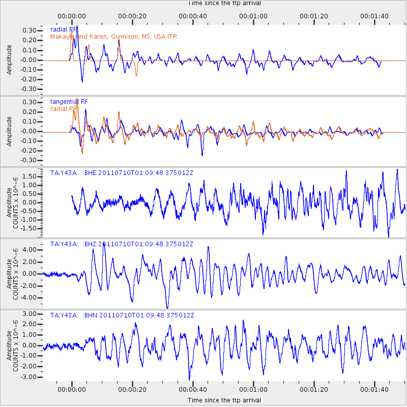
Y43A Makayla and Karen, Gunnison, MS, USA - Earthquake Result Viewer
*The percent match for this event was below the threshold and hence no stack was calculated.
| Earthquake location: |
Off East Coast Of Honshu, Japan |
| Earthquake latitude/longitude: |
38.0/143.3 |
| Earthquake time(UTC): |
2011/07/10 (191) 00:57:10 GMT |
| Earthquake Depth: |
23 km |
| Earthquake Magnitude: |
6.6 MB, 7.0 MS, 7.0 MW, 7.0 MW |
| Earthquake Catalog/Contributor: |
WHDF/NEIC |
|
| Network: |
TA USArray Transportable Network (new EarthScope stations) |
| Station: |
Y43A Makayla and Karen, Gunnison, MS, USA |
| Lat/Lon: |
33.91 N/90.93 W |
| Elevation: |
46 m |
|
| Distance: |
92.5 deg |
| Az: |
42.46 deg |
| Baz: |
320.134 deg |
| Ray Param: |
$rayparam |
*The percent match for this event was below the threshold and hence was not used in the summary stack. |
|
| Radial Match: |
92.058716 % |
| Radial Bump: |
400 |
| Transverse Match: |
82.57088 % |
| Transverse Bump: |
357 |
| SOD ConfigId: |
395004 |
| Insert Time: |
2011-12-16 07:04:57.772 +0000 |
| GWidth: |
2.5 |
| Max Bumps: |
400 |
| Tol: |
0.001 |
|
Signal To Noise
| Channel | StoN | STA | LTA |
| TA:Y43A: :BHZ:20110710T01:09:48.375012Z | 2.9810274 | 4.7296018E-7 | 1.5865677E-7 |
| TA:Y43A: :BHN:20110710T01:09:48.375012Z | 0.7557292 | 2.0672903E-7 | 2.7354906E-7 |
| TA:Y43A: :BHE:20110710T01:09:48.375012Z | 1.5351245 | 4.401743E-7 | 2.8673523E-7 |
| Arrivals |
| Ps | |
| PpPs | |
| PsPs/PpSs | |


