P39B Salisbury, MO, USA - Earthquake Result Viewer
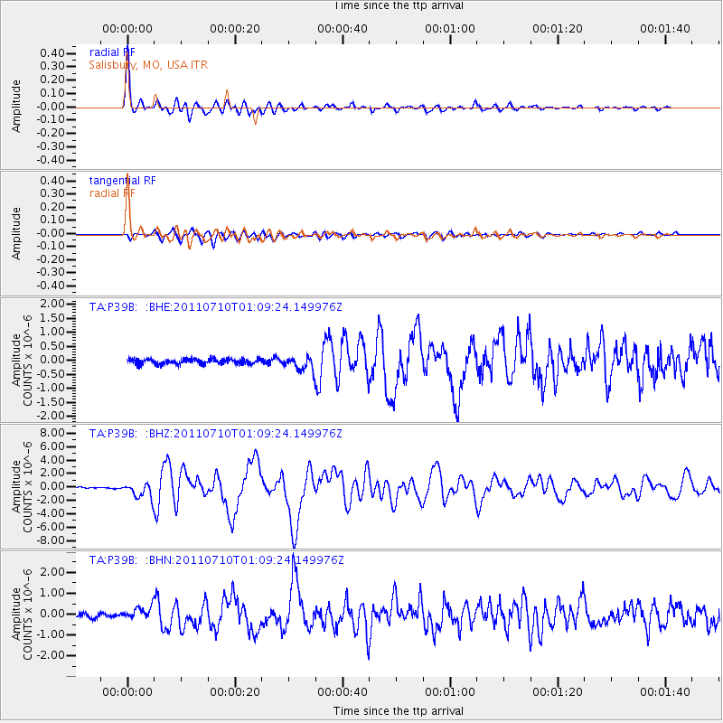
Earthquake location: Off East Coast Of Honshu, Japan
Earthquake latitude/longitude: 38.0/143.3
Earthquake time(UTC): 2011/07/10 (191) 00:57:10 GMT
Earthquake Depth: 23 km
Earthquake Magnitude: 6.6 MB, 7.0 MS, 7.0 MW, 7.0 MW
Earthquake Catalog/Contributor: WHDF/NEIC
Network: TA USArray Transportable Network (new EarthScope stations)
Station: P39B Salisbury, MO, USA
Lat/Lon: 39.49 N/92.75 W
Elevation: 226 m
Distance: 87.3 deg
Az: 39.971 deg
Baz: 319.041 deg
Ray Param: 0.043396432
Estimated Moho Depth: 22.75 km
Estimated Crust Vp/Vs: 1.70
Assumed Crust Vp: 6.498 km/s
Estimated Crust Vs: 3.833 km/s
Estimated Crust Poisson's Ratio: 0.23
Radial Match: 96.637955 %
Radial Bump: 400
Transverse Match: 89.12651 %
Transverse Bump: 400
SOD ConfigId: 395004
Insert Time: 2011-12-16 07:06:16.183 +0000
GWidth: 2.5
Max Bumps: 400
Tol: 0.001

Signal To Noise

ChannelStoNSTALTA
TA:P39B: :BHZ:20110710T01:09:24.149976Z14.2793951.1628555E-68.143591E-8
TA:P39B: :BHN:20110710T01:09:24.149976Z3.37893032.9933E-78.858721E-8
TA:P39B: :BHE:20110710T01:09:24.149976Z2.76548152.532417E-79.157237E-8
Arrivals
Ps2.5 SECOND
PpPs9.2 SECOND
PsPs/PpSs12 SECOND