Q42A Golden Eagle, IL, USA - Earthquake Result Viewer
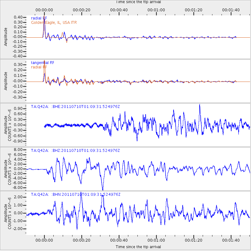
Earthquake location: Off East Coast Of Honshu, Japan
Earthquake latitude/longitude: 38.0/143.3
Earthquake time(UTC): 2011/07/10 (191) 00:57:10 GMT
Earthquake Depth: 23 km
Earthquake Magnitude: 6.6 MB, 7.0 MS, 7.0 MW, 7.0 MW
Earthquake Catalog/Contributor: WHDF/NEIC
Network: TA USArray Transportable Network (new EarthScope stations)
Station: Q42A Golden Eagle, IL, USA
Lat/Lon: 38.91 N/90.53 W
Elevation: 175 m
Distance: 88.9 deg
Az: 39.026 deg
Baz: 320.408 deg
Ray Param: 0.042251546
Estimated Moho Depth: 17.0 km
Estimated Crust Vp/Vs: 1.82
Assumed Crust Vp: 6.498 km/s
Estimated Crust Vs: 3.58 km/s
Estimated Crust Poisson's Ratio: 0.28
Radial Match: 96.5864 %
Radial Bump: 326
Transverse Match: 92.80185 %
Transverse Bump: 400
SOD ConfigId: 395004
Insert Time: 2011-12-16 07:06:23.684 +0000
GWidth: 2.5
Max Bumps: 400
Tol: 0.001

Signal To Noise

ChannelStoNSTALTA
TA:Q42A: :BHZ:20110710T01:09:31.524976Z8.5491929.908014E-71.15894146E-7
TA:Q42A: :BHN:20110710T01:09:31.524976Z3.18689562.6281205E-78.246648E-8
TA:Q42A: :BHE:20110710T01:09:31.524976Z2.82426021.28614E-74.5539007E-8
Arrivals
Ps2.2 SECOND
PpPs7.2 SECOND
PsPs/PpSs9.4 SECOND