
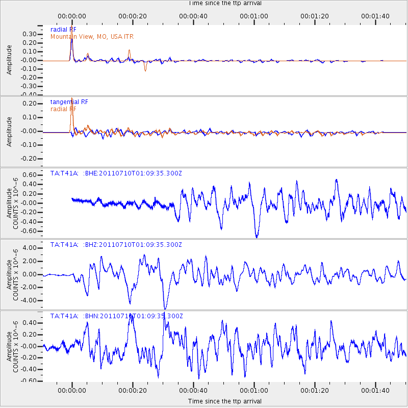
T41A Mountain View, MO, USA - Earthquake Result Viewer
| ||||||||||||||||||
| ||||||||||||||||||
| ||||||||||||||||||
|
Signal To Noise
| Channel | StoN | STA | LTA |
| TA:T41A: :BHZ:20110710T01:09:35.300Z | 12.484364 | 1.0169302E-6 | 8.1456314E-8 |
| TA:T41A: :BHN:20110710T01:09:35.300Z | 2.8458805 | 1.4529516E-7 | 5.1054553E-8 |
| TA:T41A: :BHE:20110710T01:09:35.300Z | 3.0690181 | 1.4408555E-7 | 4.694842E-8 |
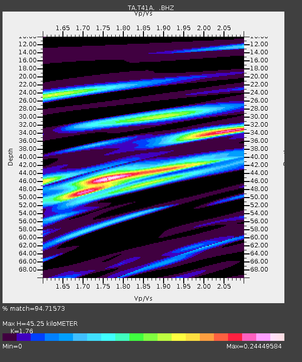
| Arrivals | |
| Ps | 5.4 SECOND |
| PpPs | 19 SECOND |
| PsPs/PpSs | 24 SECOND |

