V41A Mountainview, AR, USA - Earthquake Result Viewer
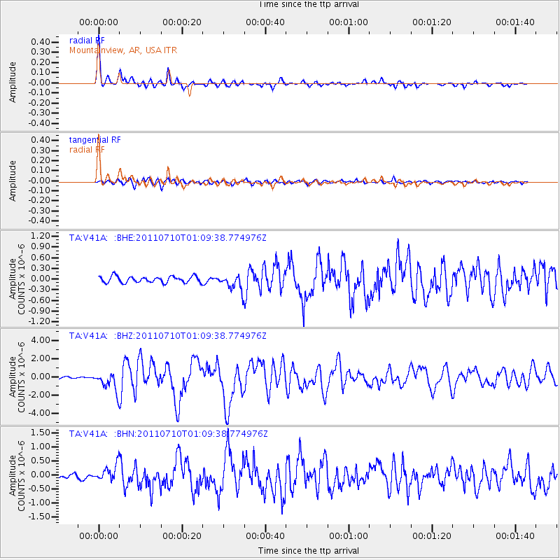
Earthquake location: Off East Coast Of Honshu, Japan
Earthquake latitude/longitude: 38.0/143.3
Earthquake time(UTC): 2011/07/10 (191) 00:57:10 GMT
Earthquake Depth: 23 km
Earthquake Magnitude: 6.6 MB, 7.0 MS, 7.0 MW, 7.0 MW
Earthquake Catalog/Contributor: WHDF/NEIC
Network: TA USArray Transportable Network (new EarthScope stations)
Station: V41A Mountainview, AR, USA
Lat/Lon: 35.79 N/92.16 W
Elevation: 413 m
Distance: 90.4 deg
Az: 42.024 deg
Baz: 319.447 deg
Ray Param: 0.041673005
Estimated Moho Depth: 39.25 km
Estimated Crust Vp/Vs: 1.82
Assumed Crust Vp: 6.498 km/s
Estimated Crust Vs: 3.575 km/s
Estimated Crust Poisson's Ratio: 0.28
Radial Match: 95.586235 %
Radial Bump: 331
Transverse Match: 84.110565 %
Transverse Bump: 400
SOD ConfigId: 395004
Insert Time: 2011-12-16 07:06:42.854 +0000
GWidth: 2.5
Max Bumps: 400
Tol: 0.001

Signal To Noise

ChannelStoNSTALTA
TA:V41A: :BHZ:20110710T01:09:38.774976Z12.5676241.0766701E-68.567014E-8
TA:V41A: :BHN:20110710T01:09:38.774976Z3.53770182.9601313E-78.367385E-8
TA:V41A: :BHE:20110710T01:09:38.774976Z2.6529412.352797E-78.868637E-8
Arrivals
Ps5.0 SECOND
PpPs17 SECOND
PsPs/PpSs22 SECOND