
K39A Oelwein, IA, USA - Earthquake Result Viewer
| ||||||||||||||||||
| ||||||||||||||||||
| ||||||||||||||||||
|
Signal To Noise
| Channel | StoN | STA | LTA |
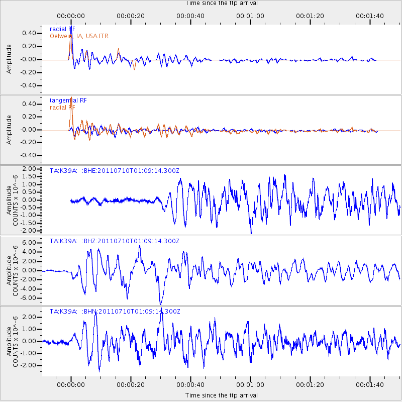
| TA:K39A: :BHZ:20110710T01:09:14.300Z | 25.581545 | 2.0872044E-6 | 8.159024E-8 |
| TA:K39A: :BHN:20110710T01:09:14.300Z | 5.431647 | 6.883609E-7 | 1.2673152E-7 |
| TA:K39A: :BHE:20110710T01:09:14.300Z | 6.323081 | 5.9195395E-7 | 9.361797E-8 |
| Arrivals | |
| Ps | 3.9 SECOND |
| PpPs | 16 SECOND |
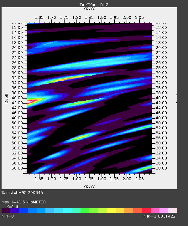
| PsPs/PpSs | 20 SECOND |

