L40A Anamosa, IA, USA - Earthquake Result Viewer
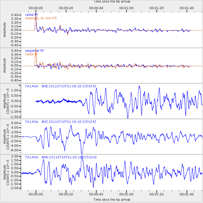
Earthquake location: Off East Coast Of Honshu, Japan
Earthquake latitude/longitude: 38.0/143.3
Earthquake time(UTC): 2011/07/10 (191) 00:57:10 GMT
Earthquake Depth: 23 km
Earthquake Magnitude: 6.6 MB, 7.0 MS, 7.0 MW, 7.0 MW
Earthquake Catalog/Contributor: WHDF/NEIC
Network: TA USArray Transportable Network (new EarthScope stations)
Station: L40A Anamosa, IA, USA
Lat/Lon: 42.06 N/91.22 W
Elevation: 242 m
Distance: 86.1 deg
Az: 37.411 deg
Baz: 319.891 deg
Ray Param: 0.044266436
Estimated Moho Depth: 41.0 km
Estimated Crust Vp/Vs: 1.60
Assumed Crust Vp: 6.53 km/s
Estimated Crust Vs: 4.082 km/s
Estimated Crust Poisson's Ratio: 0.18
Radial Match: 96.449425 %
Radial Bump: 385
Transverse Match: 82.54511 %
Transverse Bump: 400
SOD ConfigId: 395004
Insert Time: 2011-12-16 07:09:15.621 +0000
GWidth: 2.5
Max Bumps: 400
Tol: 0.001

Signal To Noise

ChannelStoNSTALTA
TA:L40A: :BHZ:20110710T01:09:18.325024Z14.083571.7849288E-61.2673839E-7
TA:L40A: :BHN:20110710T01:09:18.325024Z5.58966355.0403173E-79.017211E-8
TA:L40A: :BHE:20110710T01:09:18.325024Z4.7290353.5086427E-77.419363E-8
Arrivals
Ps3.9 SECOND
PpPs16 SECOND
PsPs/PpSs20 SECOND